place

Carneros Creek (Santa Barbara County, California)

Rivers of Santa Barbara County, CaliforniaRivers of Southern California

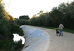
Carneros Creek is a southward flowing stream originating in the Santa Ynez Mountains, in Santa Barbara County, California. It flows to Lake Los Carneros Park, under U. S. Highway 101 where it runs in a man-made channel diverted to the west of Santa Barbara Municipal Airport, until it meets Goleta Slough, from whence its waters flow to the Santa Barbara Channel of the Pacific Ocean.

Excerpt from the Wikipedia article Carneros Creek (Santa Barbara County, California) (License: CC BY-SA 3.0, Authors).

Carneros Creek (Santa Barbara County, California)
Sandspit Road,

Geographical coordinates (GPS) Address Nearby Places
placeShow on map

Wikipedia: Carneros Creek (Santa Barbara County, California)Continue reading on Wikipedia

Geographical coordinates (GPS)

Latitude Longitude
N 34.416944444444 ° E -119.83027777778 °
placeShow on map

Address

Sandspit Road
93106
California, United States
mapOpen on Google Maps

Share experience

Nearby Places

AlloSphere
AlloSphere

The AlloSphere is a research facility in a theatre-like pavilion in a spherical shape, of opaque material, used to project computer-generated imagery and sounds. Included are GIS, scientific, artistic, and other information. Located at the University of California, Santa Barbara (UCSB) the AlloSphere grew out of the schools of electrical engineering and computer science, and the Media Arts & Technology program at UCSB.The AlloSphere is housed at UCSB California NanoSystems Institute building, "CNSI," or Elings Hall, a 62,000-square-foot (5,800 m2) facility that opened in 2007. The AlloSphere is intended to integrate technology and media.The AlloSphere includes a three-story cube that has been insulated extensively with sound-absorbing material, making it one of the largest echo-less chambers in the world. Within the chamber are two hemispheres of 5 meter radii, made of perforated aluminum. These are opaque and acoustically transparent.There are 26 video projectors, to create as much of a field of vision as possible.The loudspeaker real-time sound synthesis cluster (140 individual speaker elements plus sub-woofers) is suspended behind the aluminum screen resulting in 3-D audio. Computation clusters include simulation, sensor-array processing, real-time video processing for motion-capture and visual computing, render-farm/real-time ray-tracing and radiosity cluster, and content and prototyping environments.The AlloSphere was developed by a team of scientists, led primarily by Professor JoAnn Kuchera-Morin, a professor in the field of Composition, of the Media Arts & Technology Program of UCSB.

La Goleta Gas Field
La Goleta Gas Field

The La Goleta Gas Field (also known as the Goleta Gas Field and La Goleta Storage Field) is a natural gas field in unincorporated Santa Barbara County, California, adjacent to the city of Goleta. Discovered in 1929, and first put into production in 1932, it has been in continuous use ever since, producing approximately 12 billion cubic feet of gas. With production declining, the field was converted into a gas storage reservoir in 1941. As of 2016 it remains one of the four gas storage facilities maintained by Southern California Gas Company (SoCalGas), a division of Sempra Energy, with the others being Aliso Canyon, Honor Rancho and Playa del Rey. It is the oldest storage facility of the four and the third largest, with a maximum capacity of 21.5 billion cubic feet. The storage facilities are necessary to balance load for the over ten million customers of SoCalGas: during summer months, when gas usage is at a minimum, gas is pumped into the reservoirs; and in the winter when usage is high, gas is withdrawn. The La Goleta field serves the northern portion of SoCalGas's geographic range.In 2013 the field had 19 active gas wells and two observation wells. SoCalGas installed four new production wells in 2014-2015 after filing an Environmental Impact Report and obtaining a Land Use Permit from Santa Barbara County. The new wells pull gas from geologic units deeper than the existing storage reservoir, which is about 4,000 feet below ground surface.

UCSB Center for Spatial Studies and Data Science

The Center for Spatial Studies and Data Science (@spatial) is a research center at the University of California, Santa Barbara built on a rich legacy of providing visionary and interdisciplinary leadership in geographic data science. Formerly named the Center for Spatial Studies, @spatial was founded in 2008 by Michael Goodchild, and focuses on spatial thinking across domains, spatial intelligence, geoinformatics, geographic information science, and geographic information systems. Founded on values of excellence and inclusion, the mission of the Center for Spatial Studies and Data Science is to serve the UC Santa Barbara campus, the local community, and society by accelerating scientific discovery, education, and access to actionable solutions. The Center hosts speakers, workshops, and visiting researchers as well as the annual Specialist Meeting that brings global experts together on emerging topics in spatial data science to fuel discussion and set research agendas. The Center consists of core researchers engaged in center management and initiatives, affiliate researchers across UC Santa Barbara interested in participating in Center activities, a Trainee Network of post-docs, graduate students, and undergraduate students, support staff, and valued external partners. Community engagement and outreach is a priority of the Center, with efforts including the Earth + Humans podcast about the challenges brought on by human’s interactions with the environment and the Community GIS Initiative, which aims to increase access to GIS solutions by creating a pathway to those who have GIS skills.