Lam Tei
Commons link is defined as the pagenameHong Kong geography stubsLam Tei

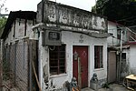
Lam Tei (Chinese: 藍地) is an area in the Tuen Mun District of the New Territories, Hong Kong. The region lies at the north end of Tuen Mun city. It is highly rural, with Miu Fat Buddhist Monastery being a landmark of the region.
Excerpt from the Wikipedia article Lam Tei (License: CC BY-SA 3.0, Authors, Images).Lam Tei
Castle Peak Road – Lam Tei, Tuen Mun District
Geographical coordinates (GPS) Address Nearby Places Show on map
 Continue reading on Wikipedia
 Geographical coordinates (GPS)
| Latitude | Longitude |
|---|---|
| N 22.419184 ° | E 113.982707 ° |
Address
青山公路-藍地段 Castle Peak Road – Lam Tei
Castle Peak Road – Lam Tei
Tuen Mun District
Hong Kong, China
Open on Google Maps