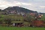
Pilgrims' Trail (Slovenia)
Hiking trails in SloveniaMunicipality of ŠentrupertSlovenia geography stubs

The Pilgrims' Trail (Slovene: Pot romarjev) is a 28-kilometre-long (17 mi) trail in southeastern Slovenia. It runs from Mount Sorrow (Žalostna gora) above Mokronog through Šentrupert, past the Church of St. Francis Xavier in Vesela Gora ("Mount Joy"), and to the Zaplaz Pilgrimage Church in Čatež. The entire walk takes 6 to 7 hours. An organised pilgrimage takes place on the trail every year on the second Sunday of May. The path is maintained by the mountaineering club from Šentrupert, whereas the event is organised by the cultural society of Šentrupert.
Excerpt from the Wikipedia article Pilgrims' Trail (Slovenia) (License: CC BY-SA 3.0, Authors, Images).Pilgrims' Trail (Slovenia)
Martinja vas pri Mokronogu, Mokronog-Trebelno
Geographical coordinates (GPS) Address Nearby Places Show on map
Geographical coordinates (GPS)
| Latitude | Longitude |
|---|---|
| N 45.941491666667 ° | E 15.137836111111 ° |
Address
Martinja vas pri Mokronogu
8230 Mokronog-Trebelno
Slovenia
Open on Google Maps


