Roborough, Torridge
Civil parishes in DevonTorridge DistrictVillages in Devon

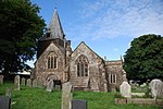
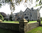
Roborough is a village and civil parish 5.5 mi (8.9 km) from Great Torrington, in Devon, England. Situated topographically on the plateau between the Torridge and Taw Rivers, the parish covers 1,258 ha (3,110 acres) and contains a population of some 258 parishioners. It is surrounded by a pastoral landscape of rectangular fields, high hedges and scattered farmsteads.
Excerpt from the Wikipedia article Roborough, Torridge (License: CC BY-SA 3.0, Authors, Images).Roborough, Torridge
West Road, Torridge District Roborough
Geographical coordinates (GPS) Address Nearby Places Show on map
Geographical coordinates (GPS)
| Latitude | Longitude |
|---|---|
| N 50.935715 ° | E -4.027534 ° |
Address
West Road
West Road
EX19 8SY Torridge District, Roborough
England, United Kingdom
Open on Google Maps


