Breisgau
Austrian CircleCarolingian countiesFormer states and territories of Baden-WürttembergRegions of Baden-Württemberg

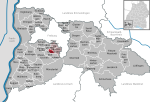
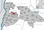
The Breisgau (German pronunciation: [ˈbʁaɪ̯sɡaʊ̯] (listen)) is an area in southwest Germany between the Rhine River and the foothills of the Black Forest. Part of the state of Baden-Württemberg, it centers on the city of Freiburg im Breisgau. The district of Breisgau-Hochschwarzwald, which partly consists of the Breisgau, is named after the Black Forest area. Parts of the Breisgau are also situated in the political districts of Freiburg im Breisgau and Emmendingen.
Excerpt from the Wikipedia article Breisgau (License: CC BY-SA 3.0, Authors, Images).Breisgau
Bergstraße, GVV Hexental
Geographical coordinates (GPS) Address Nearby Places Show on map
Geographical coordinates (GPS)
| Latitude | Longitude |
|---|---|
| N 47.933333333333 ° | E 7.8166666666667 ° |
Address
Bergstraße 6
79294 GVV Hexental
Baden-Württemberg, Germany
Open on Google Maps


