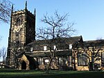
Altofts
Geography of the City of WakefieldNormanton, West YorkshireUse British English from January 2021Villages in West Yorkshire

Altofts is a village in West Yorkshire, England. It lies 5 miles (8 km) north-east from the centre of Wakefield and less than 1 mile (1.6 km) north-west of Normanton. The M62 runs close to the village to the north-east, and the Aire and Calder Navigation to the north-west. The village is part of the civil parish of Normanton, but for local elections it is part of the ward of Altofts and Whitwood, which also includes the western part of Castleford.
Excerpt from the Wikipedia article Altofts (License: CC BY-SA 3.0, Authors, Images).Altofts
Neville Street, Wakefield
Geographical coordinates (GPS) Address Nearby Places Show on map
Geographical coordinates (GPS)
| Latitude | Longitude |
|---|---|
| N 53.697 ° | E -1.416 ° |
Address
Neville Street 2
WF6 1HU Wakefield
England, United Kingdom
Open on Google Maps


