place

Conestoga Trail System
Hiking trails in PennsylvaniaLong-distance trails in the United StatesUse mdy dates from January 2022
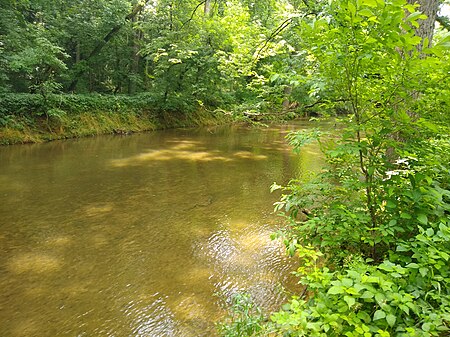
CST 3 ConestogaRiver

The Conestoga Trail System is a 65.8-mile (105.9 km) linear hiking trail in Lancaster County, Pennsylvania. The system connects several relatively short and discontinuous footpaths with walks on paved roads. About 53% of the network's distance is made up of road walking, and those segments are intended to showcase the rural scenery of Lancaster County, utilizing three covered bridges and passing numerous Amish and Mennonite farms, as well as some urban and suburban neighborhoods in and around Lancaster. The footpath segments offer wilderness scenery of the type that can be found in many of Pennsylvania's forested areas, plus some walks alongside farm fields.Most of the off-road portions of the route are on private property, so except for several miles near the south end of the route, camping is prohibited along most of the Conestoga Trail System. The trail route is maintained by Lancaster Hiking Club, which regularly searches for options to relocate the route off of roads and into private or public woods and fields, so the route and distance of the Conestoga Trail System are known to change periodically.

Excerpt from the Wikipedia article Conestoga Trail System (License: CC BY-SA 3.0, Authors, Images).

Conestoga Trail System
River Road, Lower Chanceford Township

Geographical coordinates (GPS) Address Nearby Places
placeShow on map

Wikipedia: Conestoga Trail SystemContinue reading on Wikipedia

Geographical coordinates (GPS)

Latitude Longitude
N 39.8142 ° E -76.3311 °
placeShow on map

Address

River Road

River Road
Lower Chanceford Township
Pennsylvania, United States
mapOpen on Google Maps

CST 3 ConestogaRiver
Share experience

Nearby Places

Muddy Run Pumped Storage Facility

Muddy Run Pumped Storage Facility is a pumped-storage hydroelectric generation facility in Drumore Township, Pennsylvania, United States. Constructed by the Philadelphia Electric Company and completed in 1968, Muddy Run was the largest pumped-storage facility in the world. Muddy Run has a capacity of 1,071 megawatts. The facility is operated by the Susquehanna Electric Company, a subsidiary of Constellation Energy. The facility's upper reservoir is the 1,000-acre (400 ha) Muddy Run Reservoir, with a full pool elevation of over 500 feet (150 m), and a usable storage capacity of 1,466 million cubic feet (33,700 acre⋅ft; 41.5 hm3). Muddy Run Reservoir was created by damming Muddy Run with a 4,800 feet (1,500 m) long, 250 feet (76 m) high, rock-filled dam. The lower reservoir is the Conowingo Reservoir, created in the Susquehanna River by the Conowingo Dam, with a normal pool elevation of 109 feet (33 m). The power house uses excess grid capacity during off peak hours to pump water from the Conowingo Reservoir into the upper reservoir through four 25-foot (7.6 m) diameter, 343-foot (105 m) vertical shafts. During peak power demand periods, the water is allowed to flow back from the lake through the shafts to the eight turbines causing the pumps to act as generators. The Muddy Run electrical machinery was designed by the noted engineer Eugene C. Whitney of Westinghouse Electric Company, who designed the machinery for the Grand Coulee Dam #3 powerhouse. Whitney "was present when the machines were first to be started. The operator was reluctant to take the first step. Gene said, 'Call your boss.' The boss said, 'If Gene says to start the machines, start them.' So they did, and water rose from the lower Susquehanna River to the upper reservoir, 400 feet above". The upper reservoir extends into Martic Township. The area around the upper reservoir is operated as a park, complementing the nearby Susquehannock State Park. Susquehannock State Park has an overlook trail with a good view of the Muddy Run facility.