place

Westleton

Civil parishes in SuffolkEast Suffolk (district)Suffolk geography stubsVillages in Suffolk
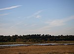
View of Westleton village, suffolk geograph.org.uk 432510

Westleton is a village and civil parish in the English county of Suffolk. It is located 4 miles (6 km) north of Leiston and 5 miles (8 km) north-east of Saxmundham near the North Sea coast. The village is on the edge of the Suffolk Sandlings, an area of lowland heathland. The village lies along the B1125 road, 2 miles (3 km) to the east of the A12 and Darsham railway station. Westleton Heath National Nature Reserve is 0.5 miles (1 km) north east of the village. The heath is crossed by a minor road from Westleton to the coastal village of Dunwich, 2 miles (3 km) to the east. The famous Minsmere RSPB reserve lies immediately to the east of the village. The fourteenth-century village church of St Peter in Westleton was built by monks from Sibton Abbey near Saxmundham. The church has twice seen the collapse of its tower: in 1776 under the strain of hurricane winds; and during World War II, when the smaller wooden replacement had to be demolished following bomb damage. It is a grade II* listed building. Westleton retains some other basic services, helped by its proximity to the coast and Minsmere. These include a post office, two bookshops, a garage and two pubs, the White Horse and The Crown. The latter is a historic coaching inn dating from the 12th century. The bookshop, Chapel Books, has been depicted in print in Julie Myerson's 2003 novel, Something Might Happen, as the location for a seduction scene.

Excerpt from the Wikipedia article Westleton (License: CC BY-SA 3.0, Authors, Images).

Westleton
The Street, East Suffolk

Geographical coordinates (GPS) Address Nearby Places
placeShow on map

Wikipedia: WestletonContinue reading on Wikipedia

Geographical coordinates (GPS)

Latitude Longitude
N 52.264982 ° E 1.575395 °
placeShow on map

Address

Westleton Crown

The Street
IP17 3AD East Suffolk
England, United Kingdom
mapOpen on Google Maps

View of Westleton village, suffolk geograph.org.uk 432510
Share experience

Nearby Places

Leiston Abbey
Leiston Abbey

Leiston Abbey outside the town of Leiston, Suffolk, England, was a religious house of Canons Regular following the Premonstratensian rule (White canons), dedicated to St Mary. Founded in c. 1183 by Ranulf de Glanville (c. 1112-1190), Chief Justiciar to King Henry II (1180-1189), it was originally built on a marshland isle near the sea, and was called "St Mary de Insula". Around 1363 the abbey suffered so much from flooding that a new site was chosen and it was rebuilt further inland for its patron, Robert de Ufford, 1st Earl of Suffolk (1298-1369). However, there was a great fire in c. 1379 and further rebuilding was necessary. The house was suppressed in 1537. A Cartulary or monastic register survives. The Abbey's annual rolls of their court of wreck from 1378 to 1481 are a most important historical resource. A series of late visitations, and a list of abbots, are in Premonstratensian records. The impressive remains of the second abbey stand in the fields to the west of the road going north out of Leiston towards Theberton. After the Abbey was closed the estate was granted to Charles Brandon, 1st Duke of Suffolk. The Abbey became a farm, the farmhouse being built into the abbey walls. A Georgian frontage was added to the house, which was extended in the 1920s. In 1928 the ruins and farm were bought by Ellen Wrightson for use as a religious retreat. At her death in 1946 she bequeathed the house, ruins, land and buildings to the Diocese of St Edmundsbury and Ipswich. It was purchased in 1977 to become the home of the Pro Corda Trust, a centre for the specialized education and training of chamber musicians. The site is managed by them, and is in the guardianship of English Heritage.

RSPB Minsmere
RSPB Minsmere

RSPB Minsmere is a nature reserve owned and managed by the Royal Society for the Protection of Birds (RSPB) at Minsmere, Suffolk. The 1,000-hectare (2,500-acre) site has been managed by the RSPB since 1947 and covers areas of reed bed, lowland heath, acid grassland, wet grassland, woodland and shingle vegetation. It lies within the Suffolk Coast and Heaths Area of Outstanding Natural Beauty and the Suffolk Heritage Coast area. It is conserved as a Site of Special Scientific Interest, Special Area of Conservation, Special Protection Area and Ramsar site. The nature reserve is managed primarily for bird conservation, particularly through control and improvement of wetland, heath and grassland habitats, with particular emphasis on encouraging nationally uncommon breeding species such as the bittern, stone-curlew, marsh harrier, nightjar and nightingale. The diversity of habitats has also led to a wide variety of other animals and plants being recorded on the site. Before becoming a nature reserve, the area was the site of an ancient abbey and a Tudor artillery battery. The marshes were reclaimed as farmland in the 19th century, but were re-flooded during World War II as a protection against possible invasion. The reserve has a visitor centre, eight bird hides and an extensive network of footpaths and trails. Entry is free for RSPB members. Potential future threats to the site include flooding or salination as climate change causes rising sea levels, coastal erosion and possible effects on water levels due to the construction of a new reactor at the neighbouring Sizewell nuclear power stations.