place

Knayton with Brawith

Civil parishes in North YorkshireUse British English from April 2018
Knayton
Knayton

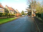
Knayton with Brawith is a civil parish in the Hambleton district of North Yorkshire, England. The parish includes the village of Knayton and the hamlet of Brawith. Knayton with Brawith can be accessed from the A19. Within the village of Knayton, there are no shops. It is 4 miles north of Thirsk and Brawith Hall is approximately a mile away from Knayton. The local primary school is Knayton Church of England Primary school, which provides education for 148 children between the ages of 4 and 11 years old. The village has a village hall that is situated on the green. The hall sits 100 people and has kitchen and accessibility facilities. In the 1870s John Marius Wilson, described Knayton with Brawith as: "A township and a sub-district, in Thirsk district, N. R. Yorkshire. The township lies 4 miles NNE of Thirsk"

Excerpt from the Wikipedia article Knayton with Brawith (License: CC BY-SA 3.0, Authors, Images).

Geographical coordinates (GPS)

Latitude Longitude
N 54.28565 ° E -1.3372 °
placeShow on map

Address


YO7 4AY , Knayton with Brawith
England, United Kingdom
mapOpen on Google Maps

Knayton
Knayton
Share experience

Nearby Places

Borrowby, west North Yorkshire

Borrowby is a village and civil parish in North Yorkshire, England. It is situated halfway between Thirsk and Northallerton, about 25 miles (40 km) north of York, in the Vale of Mowbray, a low-lying agricultural landscape shaped by the last glaciation, that lies between two national parks, the North York Moors to the east and the Yorkshire Dales to the west. Borrowby is one of the so-called Hillside Villages and can be found towards the eastern fringe of the vale where the land begins to rise to the moors. The village is said to be of Danish origin (ending –by) when it was some kind of stronghold. It was then mentioned in the 1086 Domesday Book and other early records under various spellings of "Berghby" meaning 'village on a hill'. This exposed location has always been good for growing orchards as the hill tops escaped the glacial debris and cannot be reached by the flood plains of the river, the Cod Beck. Borrowby was once part of the parish of Leake, which is further north, and in the first half of the 19th century there was an extensive manufacture of linen. Since 1978 the village has been a conservation area.The village grew in a linear form along the main road sloping upwards to the north. It is characteristic, that to the front the buildings are separated by a broad grass verge to the main road and the backs of the properties are associated with the adjoining long plots that are accessed via a back lane. A triangular street formation divides High Borrowby from Low Borrowby and acts as a village green and centre with a public house, (The Wheatsheaf Inn), village hall and church. On the village green is an old cross which is said to have marked the border between Borrowby and the town of Gueldable, (and the two Wapentakes of Allerton and Birdforth) at a time when both townships were completely intermixed.It is clear that the structure and character of the village have not significantly changed to this day, though some original cottages have been replaced by more modern versions and gaps between the buildings have been filled. There used to be a Primitive Methodist Chapel but today only the Methodist Church remains. On many of the old buildings traces of lime wash that coated the sandstone facades are still visible.