place

Fairview (Spotsylvania County, Virginia)

Federal architecture in VirginiaHouses completed in 1837Houses in Spotsylvania County, VirginiaHouses on the National Register of Historic Places in VirginiaNational Register of Historic Places in Spotsylvania County, Virginia
Northern Virginia Registered Historic Place stubsNorthern Virginia geography stubs
Fairview (Spotsylvania County, Virginia)

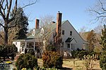
Fairview is an historic home located near Fredericksburg, Virginia at 2020 Whitelake Drive. It is the largest of the historic homes in Spotsylvania County. The house was built in 1837 by Samuel Alsop, Jr. (1776-1859). Alsop was an architect and builder who designed a number of buildings in Spotsylvania including the Old Berea Church and Kenmore Woods (1829), which he built for his daughter.After building homes for his daughters, Fairview was designed and constructed for Alsop himself. The Federal-style home is double-pile construction (meaning that there are two rooms between the front façade and the rear wall of the house). The site on which the home was built was originally 1,200 acres (490 ha). In the 1970s the land was subdivided for residences.Fairview was added to the National Register of Historic Places in December 1993.

Excerpt from the Wikipedia article Fairview (Spotsylvania County, Virginia) (License: CC BY-SA 3.0, Authors, Images).

Fairview (Spotsylvania County, Virginia)
Stoney Creek Drive, Fredericksburg Leavells

Geographical coordinates (GPS) Address Nearby Places
placeShow on map

Wikipedia: Fairview (Spotsylvania County, Virginia)Continue reading on Wikipedia

Geographical coordinates (GPS)

Latitude Longitude
N 38.240277777778 ° E -77.514722222222 °
placeShow on map

Address

Stoney Creek Drive 1402
22407 Fredericksburg, Leavells
Virginia, United States
mapOpen on Google Maps

Fairview (Spotsylvania County, Virginia)
Share experience

Nearby Places

Four Mile Fork, Virginia

Four Mile Fork is an unincorporated community in Spotsylvania County, Virginia, United States, south of the city limits of Fredericksburg. Its name derives from the junction of State Route 208, U.S. Route 1, and U.S. Route 1 Business, which is located approximately four miles south of downtown Fredericksburg. Four Mile Fork was also known as Thomas' Store.The community began developing as a suburb of Fredericksburg in the mid-20th century, with tract housing spreading out from the city along U.S. Route 1 Business (or Lafayette Boulevard). Commercial development remained predominantly small-scale and scattered until after the completion of Interstate 95 through the area in 1964. The completion of a highway interchange with U.S. Route 1 just south of Four Mile Fork spurred new development, including lodging, restaurants, and service stations. Commercial development diversified from the late 1960s through the 1980s, with the addition of multiple automotive sales businesses, a shopping center, furniture stores, a multi-screen movie theater, and other local businesses. The completion in 1980 of a regional shopping mall, Spotsylvania Mall (now Spotsylvania Towne Center) on Virginia Route 3 west of Fredericksburg, shifted the focus of commercial development from the Route 1 corridor to the west of the city, resulting in some decline in business activity and the closure or relocation of several prominent businesses. Since the 1990s, however, new development to the south along Routes 1 and 208 and the redevelopment of older commercial properties around Four Mile Fork has renewed business interest in the community. Although most of the subdivision development between Four Mile Fork and the city limits of Fredericksburg had been completed by the 1990s, in-fill residential development continues throughout the area.

Massaponax Baptist Church

Massaponax Baptist Church is a Baptist church built in the Greek Revival style, located in Spotsylvania County, Virginia. It is affiliated with the Southern Baptist Convention. The Baptist congregation that built the church was established in 1788 at a small church near Massaponax Creek. When that building became too small to hold the growing congregation, the church was moved to its present location at the intersection of U.S. Route 1 and State Route 608 (Massaponax Church Road). The new church was a small, frame building which was also outgrown. In 1859, the current brick building was constructed on the site. Kilns in a nearby field fired the bricks for the exterior walls. By October 1859 the new church was completed at a cost of $3,000. Joseph Billingsly was the first pastor in the new building. An addition was built in 1949 and a brick cottage for the pastor, was built near the church in 1956. The church was listed on the National Register of Historic Places in January 1991.Not long after the new church was occupied, the American Civil War began. Black members of the church were given letters of dismissal. Several small churches were established for the disenfranchised blacks.Church services ended for the duration of the war. During that time, the church was used as a stable, hospital, headquarters for planning strategy. Soldiers used the interior walls to draw scenes of battle, write messages, and leave names of troops, companies, and soldiers. The walls were whitewashed after the war to cover the graffiti. In 1938, during renovation work, the writing on the walls was exposed. Portions of the graffiti are now visible behind plexiglass frames. On May 21, 1864, Lieutenant General Ulysses S. Grant, Major General George Meade, other generals and their staffs met at the church after the Battle of Spotsylvania Court House. Also present was Assistant Secretary of War Charles A. Dana. During the meeting, Grant ordered his troops to carry church pews outside to provide a place for the generals to rest and plan strategy. The meeting was photographed from the second floor of the church by Timothy H. O'Sullivan, a noted 19th-century photographer of the Civil War and, later, of the Western United States.