place

Dingle Marshes

DunwichRoyal Society for the Protection of Birds reserves in EnglandSuffolk Wildlife Trust
Marsh Bog at Inch geograph.org.uk 15801

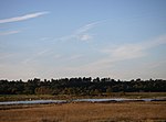
Dingle Marshes is a 93-hectare (230-acre) wildlife reserve on the North Sea coast of the English county of Suffolk. The reserve is located between Dunwich and Walberswick, approximately 4 miles (6.4 km) south-west of Southwold. The marshes make up part of the Suffolk Coast National Nature Reserve along with reserves at Walberswick and Hen Reedbeds. They are owned jointly by the RSPB and Suffolk Wildlife Trust and are managed by these two organisations and Natural England. The site is in the Dunwich Heaths and Marshes Nature Conservation Review site, Grade I, the Minsmere-Walberswick Ramsar internationally important wetland site, the Minsmere to Walberswick Heaths and Marshes Special Area of Conservation, and the Minsmere-Walberswick Special Protection Area under the European Union Directive on the Conservation of Wild Birds. It is also within the Minsmere-Walberswick Heaths and Marshes Site of Special Scientific Interest and is a Natura 2000 site. It is an internationally important site for the starlet sea anemone as well as a key site for bitterns and marsh harriers within the UK. It was purchased in 1999 at a cost of £1 million, aided by a grant from the Heritage Lottery Fund of £559,000.

Excerpt from the Wikipedia article Dingle Marshes (License: CC BY-SA 3.0, Authors, Images).

Dingle Marshes
East Suffolk

Geographical coordinates (GPS) Address Nearby Places
placeShow on map

Wikipedia: Dingle MarshesContinue reading on Wikipedia

Geographical coordinates (GPS)

Latitude Longitude
N 52.2854 ° E 1.62929 °
placeShow on map

Address

Dunwich


East Suffolk
England, United Kingdom
mapOpen on Google Maps

Marsh Bog at Inch geograph.org.uk 15801
Share experience

Nearby Places

Greyfriars, Dunwich
Greyfriars, Dunwich

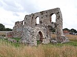
Greyfriars, Dunwich was a Franciscan friary in Dunwich in the English county of Suffolk. The friary was founded before 1277 by Richard FitzJohn and his wife Alice and dissolved in 1538. The original site, which had 20 friars in 1277 when it first appears in records, was threatened by coastal erosion and the friary was moved inland in 1289. Many of the buildings are believed to have been destroyed on dissolution, with the remains used as a house, a town hall and a jail at various times. Modern remains consist of a precinct wall, two gatehouses and some two-storey walls believed to be the remains of a cloister building, possibly a refectory or infirmary building. The site was partly excavated in the 1930s and 1990s, with geophysical surveys being carried out on the site. The site was surveyed in 2011 as part of a dig by archaeological television programme Time Team. A geophysical survey using ground-penetrating radar confirmed a range of wall features and other anomalies in the precinct and trenches uncovered carved medieval stonework and medieval window glass fragments. Geophysical surveys suggest that the friary church may have been up to 60 metres in length. Some restoration work was carried out in 2008, including the strengthening of some buildings and repair of collapsed section of the precinct wall. The site was then placed on the Heritage at Risk Register, leading to a £250,000 restoration project in 2012 by English Heritage and Suffolk County Council. The management of the site was taken over by a local voluntary group, the Dunwich Greyfriars Trust, in October 2013. The transfer occurred after budget cuts by the county council meant that the running costs would no longer be met by the council. The remains are classified as a Grade II* listed building and most of the site as a Scheduled Monument.

Dunwich Forest
Dunwich Forest

Dunwich Forest is an area of forest and lowland heath around 1 mile (1.6 km) north-west of the village of Dunwich in the English county of Suffolk. The forest covers an area of approximately 9 square kilometres (900 ha; 3.5 sq mi) and was originally planted by the Forestry Commission. The forest is within the Suffolk Coast and Heaths Area of Outstanding Natural Beauty and is in the area known as the Suffolk Sandlings. South of the reserve is the National Trust property of Dunwich Heath, one of the largest remaining areas of lowland heath on the Suffolk coast, and the RSPB reserve at Minsmere. To the north and east of the forest are Dingle Marshes, part of the Suffolk Coast National Nature Reserve. The Forestry Commission (now Forestry England) purchased land from the Dunwich and Westleton estates during the 1920s. Following the acquisition of this land, they began an afforestation programme to develop a conifer plantation, which became Dunwich Forest. The forest is now a mix of broadleaved and coniferous woodland with some areas of more open heath. In 2006 Forestry England began work on a rewilding programme at Dunwich. Working with the Suffolk Wildlife Trust and the Royal Society for the Protection of Birds, they plan to gradually replace conifers in the northern area of the forest with broad-leaved trees and to convert areas in the south of the forest to lowland heath, one of the rarest British habitats. Suffolk Wildlife Trust has introduced Dartmoor ponies to the northern area which it manages as a reserve 270 hectares (670 acres) in size.

RSPB Minsmere
RSPB Minsmere

RSPB Minsmere is a nature reserve owned and managed by the Royal Society for the Protection of Birds (RSPB) at Minsmere, Suffolk. The 1,000-hectare (2,500-acre) site has been managed by the RSPB since 1947 and covers areas of reed bed, lowland heath, acid grassland, wet grassland, woodland and shingle vegetation. It lies within the Suffolk Coast and Heaths Area of Outstanding Natural Beauty and the Suffolk Heritage Coast area. It is conserved as a Site of Special Scientific Interest, Special Area of Conservation, Special Protection Area and Ramsar site. The nature reserve is managed primarily for bird conservation, particularly through control and improvement of wetland, heath and grassland habitats, with particular emphasis on encouraging nationally uncommon breeding species such as the bittern, stone-curlew, marsh harrier, nightjar and nightingale. The diversity of habitats has also led to a wide variety of other animals and plants being recorded on the site. Before becoming a nature reserve, the area was the site of an ancient abbey and a Tudor artillery battery. The marshes were reclaimed as farmland in the 19th century, but were re-flooded during World War II as a protection against possible invasion. The reserve has a visitor centre, eight bird hides and an extensive network of footpaths and trails. Entry is free for RSPB members. Potential future threats to the site include flooding or salination as climate change causes rising sea levels, coastal erosion and possible effects on water levels due to the construction of a new reactor at the neighbouring Sizewell nuclear power stations.