Gogarloch
Areas of EdinburghEdinburgh geography stubsFormer lochsLochs of EdinburghUse British English from May 2017
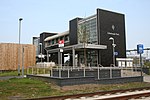
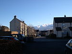
Gogarloch is a residential area within South Gyle, Edinburgh, Scotland. It lies near South Gyle railway station and South Gyle Broadway, 4+1⁄2 miles (7.2 km) west of the city centre. Corstorphine and Wester Broom are nearby. Historically this area was marshland (hence 'loch' in the name) but the land was drained in the 19th century to create space for a new railway. Most of the housing is of the 1990s era. Other lost lochs of Edinburgh include the Nor Loch and Burgh Loch on the site of the present day Meadows area.
Excerpt from the Wikipedia article Gogarloch (License: CC BY-SA 3.0, Authors).Gogarloch
Gogarloch Road, City of Edinburgh South Gyle
Geographical coordinates (GPS) Address Nearby Places Show on map
Geographical coordinates (GPS)
| Latitude | Longitude |
|---|---|
| N 55.935894444444 ° | E -3.3051583333333 ° |
Address
Gogarloch Road
Gogarloch Road
EH12 9JA City of Edinburgh, South Gyle
Scotland, United Kingdom
Open on Google Maps


