place

Larkmead, West Virginia

Unincorporated communities in West VirginiaUnincorporated communities in Wood County, West VirginiaUse mdy dates from July 2023Wood County, West Virginia geography stubs

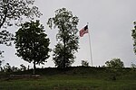
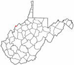
Larkmead is an unincorporated community in Wood County, West Virginia, United States.

Excerpt from the Wikipedia article Larkmead, West Virginia (License: CC BY-SA 3.0, Authors).

Larkmead, West Virginia
3rd Street,

Geographical coordinates (GPS) Address Nearby Places
placeShow on map

Wikipedia: Larkmead, West VirginiaContinue reading on Wikipedia

Geographical coordinates (GPS)

Latitude Longitude
N 39.248333333333 ° E -81.591944444444 °
placeShow on map

Address

3rd Street

3rd Street
45714
West Virginia, United States
mapOpen on Google Maps

Share experience

Nearby Places

W. H. Bickel Estate
W. H. Bickel Estate

The W.H. Bickel Estate is a 2+1⁄2-story stone mansion built between 1928 and 1930 on the outskirts of Parkersburg, West Virginia. The 1,800-square-foot (170 m2) building has a rectangular main section and a wing to the East. It is known for its architecture and a ghost that reportedly haunts the area. The main house is rich with woodwork, including intricately inlaid walnut and maple floors with geometric patterns, wood mantels, partial wainscoting on all three floors, 15 light French doors on the first floor, solid maple arched doors on the second floor, built-in china cabinets, crown molding in all main rooms, and original finish wood casement windows with roll down screens and brass hardware. There are five gas fireplaces with marble or stone hearths in the main house and two staircases, including a circular walnut and maple main staircase. The ceilings are coved on the second and third floors, and the third floor contains a ballroom or “dance hall” stretching twenty eight feet.The exterior is 4+1⁄2-inch stone veneer quarried in Philadelphia and applied with a special mortise technique. The circular drive arrives at a matching stone portico with a tongue and groove ceiling and Spanish tile porch. The roof is tile with a hip and valley on the wing side and a hip roof on the rectangular side. There are half-moon windows emerging from the tiled roof that provide side lighting to the upstairs rooms.The grounds are equally impressive with a stone carriage house, stone entrance pillars, two stone fountains (one about thirty feet in diameter with a fountain head once capable of a 50-foot fountain spray, and the second fountain contains within it a hand-carved sandstone sculpture of a mill with a waterwheel), matching stone flower boxes, and a pair of fighting lions carved from sandstone. Behind the main house is a wooden barn that was sold from the main property and converted to four apartments, but which has been repurchased and rejoined with the main property. In its prime, the Bickel Estate was a showplace, with the sweeping grounds rising to the knoll that hosts the house. At Christmas time, the entire property would be lighted with everything from the colored lights glowing through the 50-foot spray of the large fountain to the giant Christmas tree lighted by the main house. In the summertime, the fountains flowed among vast gardens of flowers lining the winding drive to the portico. “Gazing Balls” also adorned the front and side landscapes and the landscape was always immaculate and seasonal. The property once was the center of a 400-acre (160 ha) property that contained unique features such as a ½ mile horse track with grandstands and a large zoo. Today, the property maintains a noble stature in what has developed as a residential and light commercial area. Due to the work of one of the new owners, the Bickel Estate was added to the List of Registered Historic Places in West Virginia in 2001. The Bickel Mansion is located near the intersection of WV-95 and Marrtown Road in South Parkersburg.

Captain Jonathan Stone House

The Captain Jonathan Stone House is a historic residence in the city of Belpre, Ohio, United States. Built just ten years after Belpre's 1789 establishment on the north bank of the Ohio River, it is the oldest existing building in the city.Born in 1751, Jonathan Stone joined the Continental Army early in the American Revolutionary War. After the Treaty of Paris, he moved to the Belpre vicinity. He and his family built a fortification on their land during a war with local Native Americans in the early 1790s; it was known as "Stone's Fort." As the Belpre region developed, Stone became a leading member of the area's society; he was elected treasurer of Washington County, and he was one of the three commissioners chosen to survey lands for the future Ohio University in Athens to the west.Stone's house in Belpre is a two-story structure; except for a small wing on the rear northwestern corner, it is a rectangular building. The entire structure rests on a foundation of sandstone, and it is covered by a metal roof. Among its owners since Stone have been Dr. Thomas and Janet Barrett. At some point after Stone's life, the house was moved to its present location at 612 Blennerhassett Avenue. In 1978, the Stone House was listed on the National Register of Historic Places because of its historically significant architecture; it was seen as historic because of its place as a rare surviving example of Ohio's earliest residential architecture. It is one of four Belpre locations on the Register, along with the Charles Rice Ames House, the Sixth Street Railroad Bridge, and Spencer's Landing.Capt. Jonathan's son, Colonel John Stone, was another occupant of the house. He was an abolitionist with a bounty on his head offered by defenders of slavery in the state of Virginia; he therefore did not cross the river to Parkersburg (in what is now West Virginia) for more than 20 years. He is known to have "spirited many escaped slaves northward toward Canada".

Farmer's Castle
Farmer's Castle

Farmer's Castle was a defensive fortification built opposite the mouth of the Little Kanawha River on the Ohio River by a group of pioneers from the Ohio Company of Associates. It was located about 15 miles downriver of Marietta, Ohio, the first European-American settlement in the Northwest Territory. The pioneers had surveyed the land during the winter of 1788-89, and moved from Marietta to their new farms in April 1789. They called their town Belle-prairie, or modern day Belpre, Ohio. Adjacent to the island later known as Blennerhasset Island, the settlers began construction of Farmer's Castle during January 1791 for protection during the Northwest Indian War. The work was commenced the first week in January, and was prosecuted with the utmost energy, as their lives, apparently, depended on its completion. As fast as the block houses were built, the families moved into them. They were thirteen in number, arranged in two rows, with a wide street between, as shown in the engraving. The basement story was in general twenty feet square, and the upper about twenty-two feet, thus projecting over the lower one, and forming a defense from which to protect the doors and windows below, in an attack. They were built of round logs a foot in diameter, and the interstices nicely chinked and pointed with mortar. The doors and window shutters were made of thick oak planks, or puncheons, and secured with stout bars of wood on the inside. The larger timbers were hauled with ox-teams, of which they had several yokes, while the lighter for the roofs, gates, &c, were dragged along on hand sleds, with ropes, by the men. The drawing was much facilitated by a few inches of snow, which covered the ground. The pickets were made of quartered oak timber, growing on the plain back of the garrison, formed from trees about a foot in diameter, fourteen feet in length, and set four feet deep in the ground, leaving them ten feet high, over which no enemy could mount without a ladder. The smooth side was set outward, and the palisades strengthened and kept in their places by stout ribbons, or wall pieces, pinned to them with inch treenails on the inside. The spaces between the houses were filled up with pickets, and occupied three or four times the width of the houses, forming a continuous wall, or inclosure, about eighty rods in length and six rods wide. The palisades on the river side filled the whole space, and projected over the edge of the bank, leaning on rails and posts set to support them. They were sloped in this manner for the admission of air during the heat of summer.