place

St John the Baptist's Church, Smallbridge

19th-century Church of England church buildingsAnglican Diocese of ManchesterChurch of England church buildings in Greater ManchesterChurches completed in 1834Commissioners' church buildings
Former churches in Greater ManchesterGothic Revival architecture in Greater ManchesterGothic Revival church buildings in EnglandGrade II listed churches in the Metropolitan Borough of RochdaleLewis Vulliamy buildingsUse British English from September 2013
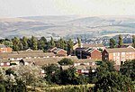
St John the Baptist Church, Smallbridge geograph.org.uk 467639

St John the Baptist's Church is in Halifax Road, Smallbridge, Rochdale, Greater Manchester, England. It is a redundant Anglican parish church in the benefice of Wardle and Smallbridge, the deanery of Rochdale, the archdeaconry of Rochdale, and the diocese of Manchester. The church is recorded in the National Heritage List for England as a designated Grade II listed building. It was a Commissioners' church, having received a grant towards its construction from the Church Building Commission.

Excerpt from the Wikipedia article St John the Baptist's Church, Smallbridge (License: CC BY-SA 3.0, Authors, Images).

St John the Baptist's Church, Smallbridge
Wheelwright Drive,

Geographical coordinates (GPS) Address Nearby Places
placeShow on map

Wikipedia: St John the Baptist's Church, SmallbridgeContinue reading on Wikipedia

Geographical coordinates (GPS)

Latitude Longitude
N 53.6338 ° E -2.132 °
placeShow on map

Address

Wheelwright Drive
OL16 2QQ , Hurstead
England, United Kingdom
mapOpen on Google Maps

St John the Baptist Church, Smallbridge geograph.org.uk 467639
Share experience

Nearby Places

Buckley, Greater Manchester

Buckley is a suburban area within the Metropolitan Borough of Rochdale, in Greater Manchester, England. It lies at the northern fringe of Rochdale, along the course of Buckley Brook, "upon an eminence of ground" by the South Pennines. It is 1.2 miles (1.9 km) south-southwest of the village of Wardle and 1.3 miles (2.1 km) north-northeast of Rochdale's town centre. Buckley spans a watercourse, a prison, farmland and residential properties. Buckley emerged as a constituent community of the manor of Hundersfield following the Anglo-Saxon settlement of Britain. Although the name Buckley is of Old English derivation, the settlement's medieval history is tied closely to a Norman family who were granted the estate as a gift for their services given in the Norman conquest of England; they subsequently adopted the surname 'de Buckley'. Members of the Buckleys of Buckley family appear throughout the High Middle Ages in legal charters related to Buckley, the surrounding area, and its manor house Buckley Hall. Throughout the Late Middle Ages and the Early Modern Period, Buckley was the principal estate of the township of Wardleworth. The Buckleys of Buckley Hall continued to hold positions of regional importance, such as priests, gentry and military officers, but their size and influence diminished through death and migration prompting the obsolescence of the Buckley estate. Industrialisation resulted in the neighbouring town of Rochdale to encroach on Buckley; the area was absorbed into the Municipal Borough of Rochdale in the 1870s. Although continuously occupied and revamped during the 18th and 19th centuries, Buckley Hall became unoccupied in the 1880s. The Brothers of Charity, an institute of the Catholic Church, successfully agitated for the purchase of Buckley Hall and its conversion into an orphanage for Catholic boys. The orphanage was operational from 1888 until 1947. The original building was demolished in the early-1990s and HM Prison Buckley Hall was opened in its place.

Belfield, Greater Manchester

Belfield is an area within Rochdale, in Greater Manchester, England. It lies at the confluence of the River Beal and River Roch, 1.3 miles (2.1 km) east-northeast of Rochdale's town centre. Belfield is bound to the east by the Rochdale Canal, which forms Rochdale's common boundary with Firgrove in Milnrow.Historically a part of Lancashire, Belfield was formerly a hamlet within the ancient township of Butterworth, and for a time held in part by the Knights Hospitaller. Belfield derives its name from the River Beal, which flows into the area from neighbouring Milnrow. A family with the surname Belfield were living in the locality during the reign of Edward III, when lands in Butterworth were conveyed to Adam de Belfield (1278–1279). In 1293–1294 Richard de Belfield conveyed to his brother Henry, "all his lands lying between the Bele (River Beal) and Stonneybeck (Stanney Brook)".For centuries a major landmark in the area was Belfield Hall, a historic house held by local dignitaries, including Alexander Butterworth and Richard Townley, who each served as the High Sheriff of Lancashire.There is a possible moated site in Belfield (grid reference SD91391362). The building on the site probably dates to c.1619 with parts rebuilt in 1752; part of the building is used as two cottages whilst the rest has been left to decay.Belfield's Anglican parish church is St Ann's. It was consecrated by the Bishop of Manchester in 1913.Belfield Bridge lies over the Rochdale Canal and is a Grade II listed structure.Belfield Community School, a primary school, lies within the locality.