place

Citadel of Namur

937 beginningsBuildings and structures completed in 1675Buildings and structures completed in the 10th centuryBuildings and structures in Namur (city)Castles in Namur (province)
Fortifications of NamurMeuse CitadelsWallonia's Major Heritage
Namur JPG07
Namur JPG07

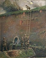
The Citadel of Namur (French: Citadelle de Namur) is a fortress in the Walloon capital city of Namur, at the confluence of the Sambre and Meuse rivers. It is originally from the Roman era, but has been rebuilt several times. Its current form was designed by Menno van Coehoorn, and improved upon by Vauban after the siege of 1692. It has been classified as a Wallonia Major Heritage site. Its highest point sits at 190 metres (620 ft). Together with Dinant, Huy and Liège, the Citadel of Namur forms part of the so-called Meuse Citadels. The original citadel dates to 937. It achieved its present extent between 1631 and 1675, when the city was under Dutch control. This section was called "Terra Nova" to distinguish it from the smaller Médiane fort built adjacent in 1542 and ensuing years. A variety of subsidiary positions were built in the 18th century. It was disestablished as a military post in 1891, superseded by a new ring of forts around Namur that were calculated to prevent the city from being attacked with artillery. This ring became the Fortified Position of Namur in the 1930s. The citadel was used as protected space for its command post.

Excerpt from the Wikipedia article Citadel of Namur (License: CC BY-SA 3.0, Authors, Images).

Citadel of Namur
Avenue Baron de Moreau, Namur

Geographical coordinates (GPS) Address Website Nearby Places
placeShow on map

Wikipedia: Citadel of NamurContinue reading on Wikipedia

Geographical coordinates (GPS)

Latitude Longitude
N 50.4605 ° E 4.864 °
placeShow on map

Address

Citadelle de Namur

Avenue Baron de Moreau
5000 Namur (Namur)
Namur, Belgium
mapOpen on Google Maps

Website
citadelle.namur.be

linkVisit website

Namur JPG07
Namur JPG07
Share experience

Nearby Places

Sambre
Sambre

The Sambre (French: [sɑ̃bʁ]; Dutch: Samber [ˈsɑmbər] ) is a river in northern France and in Wallonia, Belgium. It is a left-bank tributary of the Meuse, which it joins in the Wallonian capital Namur. The source of the Sambre is near Le Nouvion-en-Thiérache, in the Aisne département. It passes through the Franco-Belgian coal basin, formerly an important industrial district. The navigable course begins in Landrecies at the junction with the Canal de la Sambre à l'Oise, which links with the central French waterway network (or did, until navigation was interrupted in 2006 following structural failures). It runs 54 km and 9 locks 38.50m long and 5.20m wide down to the Belgian border at Jeumont. From the border the river is canalised in two distinct sections over a distance of 88 km with 17 locks. The Haute-Sambre is 39 km long and includes 10 locks of the same dimensions as in France, down to the industrial town of Charleroi. The rest of the Belgian Sambre was upgraded to European Class IV dimensions (1350-tonne barges) in the immediate post-World War II period. It lies at the western end of the sillon industriel, which is still Wallonia's industrial backbone, despite the cessation of all the coal-mining and a decline in the steel industry. The river flows into the Meuse at Namur, Belgium. The navigable waterway is managed in France by Voies Navigables de France and in Belgium by the Service Public Wallon - Direction générale opérationnelle de la Mobilité et des Voies hydrauliques (Operational Directorate of Mobility and Inland Waterways)