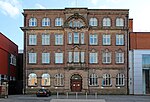
Kensington and Fairfield (ward)
Use British English from March 2015Wards of Liverpool
Kensington & Fairfield is a Liverpool City Council Ward in the Liverpool Wavertree Parliamentary constituency. The population of this ward taken at the 2011 census was 15,377. It contains the Kensington and Fairfield areas of Liverpool. It was formed for the 2004 municipal elections taking most of the former Kensington ward and small parts of the former Smithdown and Tuebrook wards.
Excerpt from the Wikipedia article Kensington and Fairfield (ward) (License: CC BY-SA 3.0, Authors).Kensington and Fairfield (ward)
Strada Way, Liverpool Everton
Geographical coordinates (GPS) Address Nearby Places Show on map
Geographical coordinates (GPS)
| Latitude | Longitude |
|---|---|
| N 53.413 ° | E -2.971 ° |
Address
Strada Way
Strada Way
L3 8DP Liverpool, Everton
England, United Kingdom
Open on Google Maps


