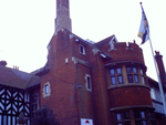
Fort Horsted

Fort Horsted is a scheduled monument (Monument Number 416040) that lies in the Horsted Valley to the South of Chatham, Kent, England. It is a late 19th-century Land Fort, and one of six constructed around Chatham and Gillingham, Kent to protect HM Dockyard Chatham from attack. Originally proposed in the Royal Commission on the Defence of the United Kingdom Report, published in 1860, it and the other land defences were omitted as part of general cost cutting with only the coastal defences on the River Medway being retained and completed under the original 1860 proposals. It was not until the mid-1870s that a revised programme was accepted, which included the construction of a convict prison at Borstal, Rochester, to provide low cost labour for the construction of a line of four forts, Fort Borstal, Fort Bridgewood, Fort Horsted and Fort Luton (a further three forts were constructed with the use of convict labour). Its construction started in 1879 and was complete by 1889 after much delay.
Excerpt from the Wikipedia article Fort Horsted (License: CC BY-SA 3.0, Authors, Images).Fort Horsted
Primrose Close,
Geographical coordinates (GPS) Address External links Nearby Places Show on map
Geographical coordinates (GPS)
| Latitude | Longitude |
|---|---|
| N 51.358 ° | E 0.513 ° |
Address
Fort Horsted
Primrose Close
ME4 6HZ
England, United Kingdom
Open on Google Maps


