place

Broadmarsh

Buildings and structures in NottinghamShopping centres in NottinghamshireTourist attractions in NottinghamUse British English from January 2019Westfield Group
Broadmarsh, Nottingham

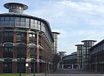
Broadmarsh is an historic area of Nottingham, England. The area was subjected to large scale slum clearance, creating large spaces used for regeneration. A shopping centre, car park, bus station and road complex created in the early 1970s cut-through the traditional thoroughfares from the city centre to the rail and canalside area. A large courts building was opened in 1981. The former shopping precinct known as The Broadmarsh Centre (rebranded in 2013 as intu Broadmarsh) was located slightly south of the centre of Nottingham, on land owned by Nottingham City Council and formerly leased to Intu Properties. It was partly demolished during renovation work by the intu group. Following Intu's financial collapse resulting in administration during 2020, the council have undertaken public consultations to find an acceptable outcome for evental redevelopment, including the former multi-storey car park and bus station.The intended demolition of the remaining precinct structure was delayed due to the City Council trying to obtain funding from central government under the Levelling up funding scheme announced in 2021. The funding bid was rejected in October 2021, meaning demolition work on the eastern end was further delayed until a new bid for £20 million funding can be submitted after spring of 2022.

Excerpt from the Wikipedia article Broadmarsh (License: CC BY-SA 3.0, Authors, Images).

Broadmarsh
Nottingham The Meadows

Geographical coordinates (GPS) Address Nearby Places
placeShow on map

Wikipedia: BroadmarshContinue reading on Wikipedia

Geographical coordinates (GPS)

Latitude Longitude
N 52.95 ° E -1.1486111111111 °
placeShow on map

Address


NG1 7EE Nottingham, The Meadows
England, United Kingdom
mapOpen on Google Maps

Broadmarsh, Nottingham
Share experience

Nearby Places

Walter Fountain
Walter Fountain

The Walter Fountain was erected at the junction of Greyfriar Gate and Lister Gate, Nottingham in 1866. The Walter Fountain was designed by Richard Charles Sutton and commissioned in memory of John Walter, MP for Nottingham, by Mr John Walter, at a cost of £1,000 (equivalent to £94,700 in 2020), with the Corporation of Nottingham providing the site, and laying in the supply of water. The foundation stone was laid on 24 October 1865 by the Mayor of Nottingham, William Page Esq. The fountain was opened on 3 July 1866 by the Mayor of Nottingham. The fountain was described in the Illustrated London News of 25 August 1866 as a structure of gothic character, highly decorated and of octagonal form. It rises in four stages to a height of 40 feet (12 m), the diameter at the base being 12 feet (3.7 m). Four basins of polished Aberdeen granite occupy four sides of the lower stage, the other four compartments being filled in with suitable inscriptions. Immediately above the basins on two sides are placed medallion portraits of the late Mr. John Walter, in white marble, considerably recessed, under traceried canopies. The first stage is surrounded by a trefoil pierced parapet. The eight compartments are finished with gablets having carved finials at the apex. The flat surface is relieved with diapered work. At the eight angles are buttresses, relieved with various pinnacles. These are carried up throughout three stages, and add much to the effect of the general outline. The second stage consists of a series of pointed arches under gablets, filled in with tracery, the lower portion containing shields bearing the town arms. The shafts in this stage are proposed to be of red Mansfield stone, having carved caps. The third stage, of diminished diameter, rises from the second stage, being connected therewith by a vertical stepping. This stage has the buttresses again diminished, and finished with pinnacles having carved terminals. From this stage the lines are brought up to a point, the apex being surmounted with an ornamental cross. A flight of octagonal steps leads up to the fountain. In September 1950, some masonry toppled into the roadway, and the Works and Ways Department of the Corporation barricaded the fountain off from the public. It was demolished a few days later.