Blaenau Gwent
1974 establishments in WalesBlaenau GwentCounty boroughs of WalesEngvarB from August 2017Incomplete lists from November 2021 ... and 3 more
Pages with Welsh IPAPages with non-numeric formatnum argumentsPrincipal areas of Wales

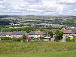
Blaenau Gwent (; Welsh: [ˈbləi.nai]) is a county borough in the south-east of Wales. It borders the unitary authority areas of Monmouthshire and Torfaen to the east, Caerphilly to the west and Powys to the north. Its main towns are Abertillery, Brynmawr, Ebbw Vale and Tredegar. Its highest point is Coity Mountain at 1,896 feet (578 m).
Excerpt from the Wikipedia article Blaenau Gwent (License: CC BY-SA 3.0, Authors, Images).Blaenau Gwent
Geographical coordinates (GPS) Address Nearby Places Show on map
Geographical coordinates (GPS)
| Latitude | Longitude |
|---|---|
| N 51.775 ° | E -3.1958333333333 ° |
Address
NP23 6EP , Hilltop
Wales, United Kingdom
Open on Google Maps


