Wrexham

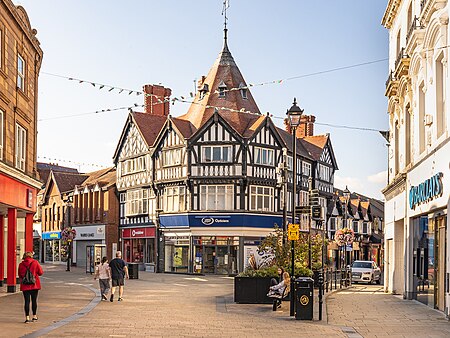
Wrexham ( REK-səm; Welsh: Wrecsam [ˈrɛksam]) is a city and the administrative centre of Wrexham County Borough in Wales. It is located between the Welsh mountains and the lower Dee Valley, near the border with Cheshire in England. Historically in the county of Denbighshire, and later the county of Clwyd in 1974, it has been the principal settlement of Wrexham County Borough since 1996. Wrexham has historically been one of the primary settlements of Wales. At the 2021 Census, it had an urban population of 44,785. The core of the city comprises the local government communities of Acton, Caia Park, Offa and Rhosddu. In the 2011 census, Wrexham's built-up area was determined to extend further into villages like Brymbo, Brynteg, Gwersyllt, New Broughton and Pentre Broughton with a population of 61,603, while also including nearby Bradley and Rhostyllen for a population of 65,692 in 2011.Wrexham was likely founded prior to the 11th century and developed in the Middle Ages as a regional centre for trade and administration. The city became the most populous settlement in Wales in the 17th century and was at the forefront of the Industrial Revolution from the 18th century. Prior to de-industrialisation in the 20th century, the city and surrounding area were a hub of coal and lead mining; the production of iron, steel and leather; and brewing.Today, Wrexham continues to serve north Wales and the Welsh borderlands as a centre for manufacturing, retail, education and administration. The city is noted for hosting Wrexham A.F.C. (one of the oldest professional football teams in the world); the nationally significant industrial heritage of the Clywedog Valley; the National Trust Property of Erddig; and the fine Tudor church of St Giles, which towers over the historic Wrexham city centre.
Excerpt from the Wikipedia article Wrexham (License: CC BY-SA 3.0, Authors, Images).Wrexham
Henblas Street, Wrexham City Centre
Geographical coordinates (GPS) Address Nearby Places Show on map
Geographical coordinates (GPS)
| Latitude | Longitude |
|---|---|
| N 53.046 ° | E -2.993 ° |
Address
The Smoke Shed
Henblas Street 10
LL13 8BD Wrexham, City Centre
Wales, United Kingdom
Open on Google Maps


