place

Hood Grange

Civil parishes in North YorkshireNorth Yorkshire geography stubsUse British English from April 2018Villages in North Yorkshire
Hood Grange
Hood Grange

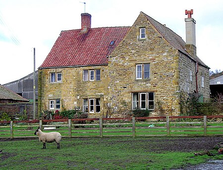
Hood Grange is a hamlet and civil parish in the Hambleton district of North Yorkshire, England. The population was less than 100 in the 2011 Census, so details are included in the civil parish of Sutton-under-Whitestonecliffe. The population of the parish was estimated at 10 in 2015. It is located near Thirsk at the foot of Sutton Bank, south of the larger village of Sutton-under-Whitestonecliffe and next to Hood Hill, which is to the south. It is notable for consisting of only a single household after its population decreased rapidly in the late 19th century. Hood Grange has existed as a civil parish since 1866, prior to which the area was part of Kilburn. A monastery known as Hood Abbey existed here from before 1138 until its dissolution in the 16th century.

Excerpt from the Wikipedia article Hood Grange (License: CC BY-SA 3.0, Authors, Images).

Hood Grange
Sutton Road,

Geographical coordinates (GPS) Address Nearby Places
placeShow on map

Wikipedia: Hood GrangeContinue reading on Wikipedia

Geographical coordinates (GPS)

Latitude Longitude
N 54.234 ° E -1.23 °
placeShow on map

Address

Sutton Road

Sutton Road
YO7 2EU , Sutton-under-Whitestonecliffe
England, United Kingdom
mapOpen on Google Maps

Hood Grange
Hood Grange
Share experience

Nearby Places

Gormire Lake
Gormire Lake

Gormire Lake is a natural lowland lake that lies at the foot of Whitestone Cliff, a western escarpment of the Hambleton Hills in the North York Moors National Park. The lake is 1.2 miles (2 km) east of the village of Sutton-under-Whitestonecliffe in North Yorkshire, England. Gormire has no inflow or major outflow of water. It is thought to be fed by an underground spring and drained by a limestone channel so the water finds a way out through the base of the cliff face to the east of the lake. The lake is also known as the White Mere, Lake Gormire, or more simply, Gormire. The name Gormire translates as filthy swamp.The lake was formed over 20,000 years ago by glacial erosion. When an ice sheet pushed its way between the Pennines and the North York Moors, it bulldozed the soft earth away and carved the cliffs at Whitestone and in turn the mud left over stopped the water's egress and formed the glacial lake. Gormire Lake was a result of this process and is fourth largest of the natural lakes in Yorkshire (the other three being Hornsea Mere, Malham Tarn and Semerwater). The lake was first designated as an Site of Special Scientific Interest (SSSI) in 1954; however, in 1985 the area surrounding the lake was incorporated into the SSSI status with the new area being 133.5 acres (54.03 ha). The new designation incorporates the broadleaf woodlands of Garbutt Wood which encroach right up to the water's edge.The lake is the setting of several myths; one being of a knight known as Sir Harry Scriven who conned the Abbot of Rievaulx Abbey into letting him ride his horse (a white mare, the so called derivation of White Mare Cliff (another name for Whitestonecliff)). The knight and the abbot rode on from an inn and as they did so, it turned into a race. The abbot then changed into the devil, which caused such panic in the knight that he couldn't stop the horse and himself plunging into Gormire Lake from the clifftop. The 'devil' was then seen to jump into the lake after them and the boiling effect of the devil in the water is what is said to have caused the darkness of the lake to this day.Other myths are that the lake is bottomless, that the bottom of the lake is the entrance to hell, there is submerged village underneath the water and that a goose once disappeared in the lake to emerge in a well at Kirkbymoorside stripped of all its feathers.Gormire Lake is popular with wild swimmers as it has no streams feeding it so there is very little current and the waters are described as being 'warm'. Swimmers have reported that it is seething with leeches. The Times named the lake as one of the 20 best lakes and rivers in Britain for wild swimming.

Kilburn White Horse
Kilburn White Horse

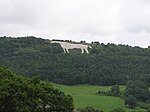
The Kilburn White Horse, grid reference SE516813, is a hill figure cut into the hillside in the North York Moors National Park near Kilburn in North Yorkshire, England. The figure is 318 feet (97 m) long by 220 ft (67 m) high and covers about 1.6 acres (6,475 m2) and said to be the largest and most northerly hill figure in England.Located on the southern flank of Sutton Bank, near Roulston Scar at the edge of the Hambleton table-land, it faces south-south-west and is visible from some distance, particularly from the East Coast Main Line railway south of Thirsk, and from the A19. On a clear day, the horse is visible from north Leeds, 28 miles (45 km) away on the higher ground to the west of the Vale of York. Sutton Bank, geologically, is formed of sandstone and the horse was created by removing the topsoil and exposing the underlying rock and covering it with white limestone chips. It was created in November 1857, and some accounts state that it was done by schoolmaster John Hodgson and his pupils, together with local volunteers. A tablet erected at the car park below it reads, "The Kilburn 'White Horse' -- This figure was cut in 1857 on the initiative of Thomas Taylor, a native of Kilburn. In 1925 a restoration fund was subscribed by the readers of the Yorkshire Evening Post and the residue of £100 was invested to provide for the triennial grooming of the figure." However, Morris Marples in his 1949 book gives Thomas Taylor the credit for being the prime mover: a native of Kilburn, he was a buyer for a London provision merchant. He seems to have attended celebrations at the Uffington White Horse in 1857, and he was inspired to give his home village a similar example. Thirty-three men were involved in cutting it, and 6 tons (6.1 metric tonnes) of lime were used to whiten the exposed rock. Nowadays a car park is provided below the white horse and there is a footpath ascending past it and crossing immediately above it. The image itself is now formed of off-white limestone chips, but the steep gradient of the hillside, especially at the horse's breast and forelegs, have led to slumping and retention boards have been fixed to restrain this. The footpath offers a scenic view. The car park is located on a steeply graded minor road between Kilburn village and the Sutton Bank National Park Centre on the A170 road, and the best view of the white horse itself is from the Bagby road; benches are provided at the best vantage point to allow leisurely observation. During World War II the horse was covered over to prevent it from becoming a conspicuous navigation landmark for enemy bombers. This white horse can reputedly be seen from Julian's Bower, Alkborough in North Lincolnshire, over 45 miles (72 km) away. The horse featured in the launch video for Channel 3 North East, the rebranded version of regional ITV station Tyne Tees Television, in September 1996. The horse was repainted in 2014. The Kilburn White Horse Association, run by volunteers, handed the site to Forestry England in 2018. In 2022, the horse was resprayed at a cost of £20,000.