place

Newhouse, North Lanarkshire

AC with 0 elementsVillages in North Lanarkshire
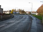
The Newhouse, at Newhouse geograph.org.uk 1591306

Newhouse is a hamlet and major road interchange located in North Lanarkshire, Scotland, sited immediately east of the Eurocentral industrial park, two miles west of the village of Salsburgh, 1.8 miles (2.9 km) east of Holytown and about 4 miles (6.4 km) north east of Motherwell. It consists of four small houses, a Premier Inn hotel and Beefeater restaurant an independently operated Esso petrol station under the name "Peggy White's Ltd"and a garden centre. It also has a large industrial park, which is the United Kingdom base for several multinational companies including Terex, Honeywell and the Newhouse research site and the Scottish distribution centre for The Co-operative Food. It was formerly a terminus for a railway line from Airdrie, and had several coal mines. Since the end of coal mining in the area these have gone, along with most of the inhabitants. It was also a historic crossing place for north–south and east–west traffic, being on the two former trunk route of the A8 between Glasgow and Edinburgh and also on the A73 from Cumbernauld and the north, to Carlisle and the south and west of England. The road junction on which the hamlet is situated remains very busy and is prone to traffic congestion at peak times, since it is where the current A8, M8, A73 (now detrunked and supplanted by the M74), A775 and B7066 all meet. It is notorious for its bad weather, as it is one of the highest points on the M8. The height also enables it to command a view over most of the Clyde Valley and Campsie Fells. Keir Hardie, the founder of the Labour Party and one of the first two Labour Party MPs elected to the UK Parliament was born in a cottage on the western edge of Newhouse. This cottage still exists on Legbrannock Avenue, now surrounded by the Newhouse Industrial Estate.

Excerpt from the Wikipedia article Newhouse, North Lanarkshire (License: CC BY-SA 3.0, Authors, Images).

Newhouse, North Lanarkshire
Newhouse Roundabout,

Geographical coordinates (GPS) Address Nearby Places
placeShow on map

Wikipedia: Newhouse, North LanarkshireContinue reading on Wikipedia

Geographical coordinates (GPS)

Latitude Longitude
N 55.83173 ° E -3.92804 °
placeShow on map

Address

Newhouse Roundabout

Newhouse Roundabout
, Newhouse
Scotland, United Kingdom
mapOpen on Google Maps

The Newhouse, at Newhouse geograph.org.uk 1591306
Share experience

Nearby Places

Monklands (district)

Monklands (Bad nam Manach in Scottish Gaelic) was, between 1975 and 1996, one of nineteen local government districts in the Strathclyde region of Scotland.The district was formed by the Local Government (Scotland) Act 1973 from: The burghs of Coatbridge and Airdrie Most of the Lanarkshire landward Ninth District The electoral district of Shottskirk from the Lanarkshire landward Seventh DistrictThe district administrative headquarters were based at Coatbridge Municipal Buildings in Coatbridge, the largest conurbation. Apart from the two burghs, the area included the following settlements: Bargeddie Calderbank Caldercruix Chapelhall Glenboig Glenmavis Greengairs Plains SalsburghThe district was abolished in 1996 by the Local Government etc. (Scotland) Act 1994. The area of the district was combined with those of Cumbernauld and Kilsyth and Motherwell districts and part of Strathkelvin to become North Lanarkshire unitary council area. The name of "Monklands" originated in the grant of lands in the area to the monks of the Cistercian Abbey of Newbattle, Midlothian in 1162. From the seventeenth century the area was formed into the two parishes of New Monkland and Old Monkland.Although the council is gone, the area is often informally referred to as Monklands. Indeed, the local hospital (in Airdrie) used to be called Monklands District General Hospital, and football matches between the two senior teams in the area, Airdrieonians and Albion Rovers, are often referred to as Monklands Derbies.

Chapelhall
Chapelhall

Chapelhall (from the Gaelic Seipeal Allt - Chapel by a burn) is a village outside the town of Airdrie in North Lanarkshire, Scotland. With house building, the distinction between Airdrie and Chapelhall is being eroded. Established as a small mining village in the 19th century, it now has population of around 6,560. Chapelhall is situated just off the M8 motorway 13 miles (21 km) east of Glasgow city centre and around 33 miles (53 km) west of Edinburgh. Chapelhall is also near to many of Lanarkshire's main towns, such as Bellshill (4 miles (6.4 km)), Coatbridge (5 miles (8.0 km)), Motherwell (5 miles (8.0 km)), Hamilton (7 miles (11 km)) and Cumbernauld (8 miles (13 km)), as well as being around 3 miles (4.8 km) away from Airdrie town centre. The Eurocentral freight village/industrial estate is just a mile or so away and employs people from around Lanarkshire, Glasgow and West Lothian. The rail-freight village links with Grangemouth docks 28 miles (45 km) away, (England to the south and beyond to mainland Europe). Chapelhall lies on the opposite side of the North Calder Water from Calderbank and is home too Chapelhall FC. Iron working and coal mining were once prominent - with three blast furnaces working in the early 1830s. The old village also had a quarry, a brickworks and a bakery. The first curator of Kew Gardens, William Aiton, began work as a gardener in Woodhall House near Chapelhall. Three Celtic FC footballers came from the village, Thomas Curley, Lisbon Lions player John Clark, and Peter Grant.