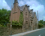
River Ribble, West Yorkshire
AC with 0 elementsAire catchmentEngland river stubsHolme ValleyRivers of Kirklees ... and 2 more
Use British English from October 2017West Yorkshire geography stubs

The River Ribble is a minor river running through the town of Holmfirth in Kirklees, West Yorkshire, England. Rising at the outflow of Holme Styes Reservoir, itself fed by Reynard Clough (which has a tributary, Catholes Gutter), Hades Clough and Long Ing Dike, the Ribble flows northwards, collecting Fox Clough and Beaver Clough from the west, before joining the River Holme by Towngate and Hollowgate in Holmfirth. The confluence of the two rivers was also marked by a weir, but this was removed in 1944 when Italian prisoners of war were tasked with removing it.
Excerpt from the Wikipedia article River Ribble, West Yorkshire (License: CC BY-SA 3.0, Authors, Images).River Ribble, West Yorkshire
Dunford Road, Kirklees Holme Valley
Geographical coordinates (GPS) Address Nearby Places Show on map
Geographical coordinates (GPS)
| Latitude | Longitude |
|---|---|
| N 53.567 ° | E -1.783 ° |
Address
Dunford Road
Dunford Road
HD9 2DP Kirklees, Holme Valley
England, United Kingdom
Open on Google Maps


