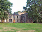
Broomfields, Bradford
Areas of BradfordHistory of BradfordModel villagesPopulated places established in 1853Use British English from July 2014

Broomfields is a historic district on the south eastern edge of Bradford, West Yorkshire, England. In 1840 it was still a mainly rural area with a population of only a few hundred people. By 1880 it was one of the most densely populated districts of Bradford with 1,500 houses, a population of about 8,000 and many commercial premises. In 1932 a process of slum clearance and commercial regeneration was started. Today (2014) the district is almost wholly given over to commercial premises and once again has a resident population of only about two hundred people.
Excerpt from the Wikipedia article Broomfields, Bradford (License: CC BY-SA 3.0, Authors, Images).Broomfields, Bradford
Linton Street, Bradford West Bowling
Geographical coordinates (GPS) Address Nearby Places Show on map
Geographical coordinates (GPS)
| Latitude | Longitude |
|---|---|
| N 53.783 ° | E -1.746 ° |
Address
Linton Street
Linton Street
BD4 7EZ Bradford, West Bowling
England, United Kingdom
Open on Google Maps


