Higher Hall

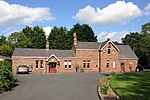
Higher Hall is a farmhouse located to the south of Edge Green in the civil parish of Edge, Cheshire, England. It is recorded in the National Heritage List for England as a designated Grade II listed building. The house dates from about 1845, and is built on the site of an earlier house. It is constructed in red brick on a stone plinth, and has a slate roof with a tiled ridge. The house consists of a rectangular block with a wing to the rear. The windows in the front of the house are sashes, and elsewhere there is a mixture of sash windows and casements. At the front of the house is a timber porch on a stone plinth with octagonal columns, behind which are pilasters.
Excerpt from the Wikipedia article Higher Hall (License: CC BY-SA 3.0, Authors, Images).Higher Hall
Higher Hall Lane,
Geographical coordinates (GPS) Address Nearby Places Show on map
Geographical coordinates (GPS)
| Latitude | Longitude |
|---|---|
| N 53.0482 ° | E -2.7585 ° |
Address
Higher Hall Lane
Higher Hall Lane
SY14 8LF , No Man's Heath and District
England, United Kingdom
Open on Google Maps


