Ringstraße (Wiesbaden)
Streets in Wiesbaden

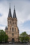
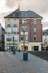
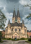
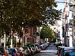
The Ringstraße is a semi-circular, some 3 km long urban boulevard in the centre of Wiesbaden and the city's busiest and most prominent street system. The Ringstraße is a four up to six lane street and part of Bundesstraße 54. It encircles the old town of Wiesbaden on its southern and western boundaries.
Excerpt from the Wikipedia article Ringstraße (Wiesbaden) (License: CC BY-SA 3.0, Authors, Images).Ringstraße (Wiesbaden)
Kaiser-Friedrich-Ring, Wiesbaden
Geographical coordinates (GPS) Address Nearby Places Show on map
Geographical coordinates (GPS)
| Latitude | Longitude |
|---|---|
| N 50.072222222222 ° | E 8.2355555555556 ° |
Address
Kaiser-Friedrich-Ring 62
65185 Wiesbaden (Mitte)
Hesse, Germany
Open on Google Maps

