place

Toni-Seelos-Olympiaschanze

1930 establishments in AustriaAustrian sports venue stubsInnsbruck-Land DistrictOlympic Nordic combined venuesOlympic biathlon venues
Olympic ski jumping venuesSki jumping stubsSki jumping venues in AustriaSports venue stubsSports venues completed in 1930Sports venues in Tyrol (state)Venues of the 1964 Winter OlympicsVenues of the 1972 Winter OlympicsVenues of the 2012 Winter Youth OlympicsWinter Olympic venue stubs
Ski jumps Seefeld
Ski jumps Seefeld

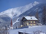
Toni-Seelos-Olympiaschanze is a ski jumping hill in Seefeld outside of Innsbruck, Austria. It is a part of the Seefeld Nordic Competence Centre consisting of two hills, a normal hill with a hill size of HS109 (K-99) and medium hill with at HS75 (K-68). Next to the jumps is a cross-country skiing stadium. It opened in 1931 as Jahnschanze, but was renamed in honor of Anton Seelos in 1948.The venue was used for the normal hill competitions during the 1964 and 1976 Winter Olympics, and for the FIS Nordic World Ski Championships in 1985 and 2019. It is also regularly used for FIS Nordic Combined World Cup.

Excerpt from the Wikipedia article Toni-Seelos-Olympiaschanze (License: CC BY-SA 3.0, Authors, Images).

Toni-Seelos-Olympiaschanze
WM Stadion Zufahrt,

Geographical coordinates (GPS) Address External links Nearby Places
placeShow on map

Wikipedia: Toni-Seelos-OlympiaschanzeContinue reading on Wikipedia

Geographical coordinates (GPS)

Latitude Longitude
N 47.320833333333 ° E 11.1775 °
placeShow on map

Address

Toni Seelos Sprungschanzen (Sprungschanzen Casino Arena;Casino Stadion Seefeld)

WM Stadion Zufahrt
6100
Tyrol, Austria
mapOpen on Google Maps

linkWikiData (Q692473)
linkOpenStreetMap (362231433)

Ski jumps Seefeld
Ski jumps Seefeld
Share experience

Nearby Places

Wildsee (Seefeld)
Wildsee (Seefeld)

The Wildsee, occasionally also called the Seefelder See ("Lake Seefeld"), is a lake near the Austrian resort of Seefeld in Tirol at the foot of the Gschwandtkopf (1,495 m). It has an area of 6.1 hectares and a maximum depth of 5.1 metres. The majority of the lake belongs to the municipality of Seefeld, its south and west shores are part of Reith bei Seefeld. The lake is fed from the Haglbach, which rises below the col of the Seefelder Joch and empties into the lake in the southeast, and water from the bog of Reither Moor and other smaller springs. Its catchment area is just under 7 km2. It is drained northwards by the Seebach which empties into the River Isar. On the east shore of the lake are small beds of reed and sedge; on the west shore mixed forest runs down to the lake. South of the lake is the Reither Moor, a raised bog resulting from the silting up of the Wildsee in which mountain pine trees grow. The south shore and the Reither Moor are a nature reserve. The Wildsee probably gave the village of Seefeld, first mentioned in 1022, its name. Emperor Maximilian I used it for fish farming and had lampreys introduced, which is why the lake also bore the name Lampretensee. The breeding of this fish, a prized delicacy at that time, only lasted for a few decades, however. Today, the Wildsee is a popular bathing lake with two beaches. According to limnological research, the lake has a low to medium nutrient content. Due to the bog-like character of the lake, visibility is only about 1 to 3 metres. In 2013 the water quality was classified as excellent.The Wildsee is threatened by silting up as a result of the sediment transported to it by the Haglbach. In future a pond will be excavated east of Innsbrucker Straße in order to trap the sediment. There is also discussion about enlarging the lake.