Battle for Caen

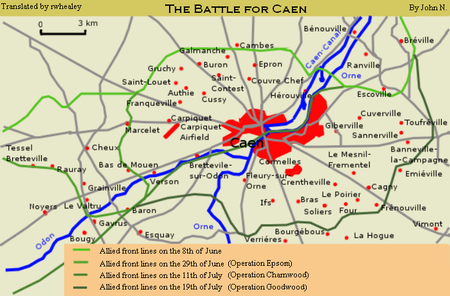
The Battle for Caen (June to August 1944) is the name given to fighting between the British Second Army and the German Panzergruppe West in the Second World War for control of the city of Caen and its vicinity during the larger Battle of Normandy. The battles followed Operation Neptune, the Allied landings on the French coast on 6 June 1944 (D-Day). Caen is about 9 mi (14 km) inland from the Calvados coast astride the Orne River and Caen Canal, at the junction of several roads and railways. The communication links made it an important operational objective for both sides. Caen and the area to its south are flatter and more open than the bocage country in western Normandy. Allied air force commanders wanted the area captured quickly to base more aircraft in France. The British 3rd Infantry Division was to seize Caen on D-Day or to dig in short of the city if the Germans prevented its capture, which would temporarily mask Caen to maintain the Allied threat against it and thwart a potential German counter-attack from the city. Caen, Bayeux and Carentan were not captured by the Allies on D-Day, and for the first week of the invasion, the Allies concentrated on linking the beachheads. British and Canadian forces resumed their attacks in the vicinity of Caen and the suburbs and city centre north of the Orne were captured during Operation Charnwood (8–9 July). The Caen suburbs south of the river were captured by the II Canadian Corps during Operation Atlantic (18–20 July). The Germans had committed most of their panzer divisions in a determined defence of Caen, which made the fighting mutually costly and greatly deprived the Germans of the means to reinforce the west end of the invasion front. In western Normandy the US First Army cut off the Cotentin Peninsula and captured Cherbourg. It then attacked southwards towards Saint-Lô, about 37 mi (60 km) west of Caen and captured the town on 19 July. On 25 July, after weather had caused a delay, the First Army began Operation Cobra on the Saint-Lô–Périers road, which was co-ordinated with the Canadian Operation Spring at Verrières (Bourguébus) ridge, south of Caen. Cobra was a great success and began the collapse of the German position in Normandy. The Allied breakout led to the Battle of the Falaise Pocket (12–21 August), which trapped most of the remnants of the 7th Army and 5th Panzer Army (formerly Panzergruppe West) and opened the way to the Seine and Paris. Caen was destroyed by Allied bombing and the damage from ground combat, which caused many French civilian casualties. After the battle, little of the prewar city remained, and reconstruction of the city took until 1962.
Excerpt from the Wikipedia article Battle for Caen (License: CC BY-SA 3.0, Authors, Images).Battle for Caen
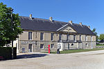
Rue des Fossés du Château, Caen
Geographical coordinates (GPS) Address Nearby Places Show on map
Geographical coordinates (GPS)
| Latitude | Longitude |
|---|---|
| N 49.186111111111 ° | E -0.3625 ° |
Address
Mur d'enceinte du Château de Caen (Château Ducal)
Rue des Fossés du Château
14000 Caen
Normandy, France
Open on Google Maps


