Point Frederick (Kingston, Ontario)
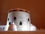
Point Frederick is a 41-hectare (101-acre) peninsula in Kingston, Ontario, Canada. The peninsula is located at the south end of the Rideau Canal where Lake Ontario empties into the St. Lawrence River. Point Frederick is bounded by the Cataraqui River (Kingston Harbour) to the west, the St. Lawrence River to the south, and Navy Bay to the east. The peninsula is occupied by the Royal Military College of Canada (RMC). Several of the buildings located on Point Frederick and the site of the old naval dockyard are national historic sites. Fort Frederick, at the south end of the peninsula, is a feature of the Kingston Fortifications National Historic Site of Canada. The peninsula was named after Frederick, Prince of Wales.
Excerpt from the Wikipedia article Point Frederick (Kingston, Ontario) (License: CC BY-SA 3.0, Authors).Point Frederick (Kingston, Ontario)
Valour Drive, Kingston
Geographical coordinates (GPS) Address Nearby Places Show on map
Geographical coordinates (GPS)
| Latitude | Longitude |
|---|---|
| N 44.228888888889 ° | E -76.468611111111 ° |
Address
Royal Military College
Valour Drive
K7K 7B4 Kingston
Ontario, Canada
Open on Google Maps


