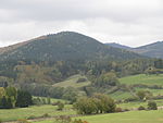
Höxterberg
Göttingen district geography stubsHills of Lower SaxonyHills of the Harz
The Höxterberg is a hill in the Harz Mountains of central Germany, that lies south of Sieber in the district of Göttingen in Lower Saxony. It is 584 metres high and lie 0.9 kilometres west of the Pagelsburg, 1.5 kilometres south of the Fissenkenkopf, 1.8 km west of the Großer Knollen and 1 kilometre north of the Mittelecke. The hill is mostly covered by beech woods. Towards the northwest the Höxterberg transitions into the Steile Wand.
Excerpt from the Wikipedia article Höxterberg (License: CC BY-SA 3.0, Authors).Höxterberg
Am Eichelbach, Harz (Landkreis Göttingen)
Geographical coordinates (GPS) Address Nearby Places Show on map
Geographical coordinates (GPS)
| Latitude | Longitude |
|---|---|
| N 51.6723 ° | E 10.4057 ° |
Address
Lübbersbuche
Am Eichelbach
37431 Harz (Landkreis Göttingen)
Lower Saxony, Germany
Open on Google Maps


