place

Trowell

Civil parishes in NottinghamshireEngvarB from May 2016Places in the Borough of BroxtoweVillages in Nottinghamshire

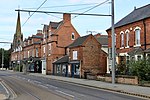
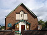
Trowell () is a village and civil parish in Nottinghamshire, England. It lies a few miles west of Nottingham, in the borough of Broxtowe on the border with Derbyshire. According to the 2001 census it had a population of 2,568, falling to 2,378 at the 2011 census.The village is believed to have Saxon origins. The parish had a population of around 50, with four manors and a church, by 1066. Coal was extracted nearby from the 13th century until 1928. The main road through the village is the A609 between Nottingham and Ilkeston and A6007 from nearby Stapleford. The M1 motorway also passes through the village, and the Trowell Motorway Services lie just to the north. Most of the village lies between the River Erewash (Derbyshire boundary) and Nottingham Canal. Herbert Morrison selected Trowell as the "Festival Village" for the 1951 Festival of Britain, as a typical example of British rural life. Conveniently close to the geographical centre of England, the village was found to be far from the a chocolate box idyll: there was no village green, and its three public houses had closed. The belching chimneys and slag heaps of an ironworks to the west dominated the village. Morrison responded to hostile questions in the House of Commons that Trowell was "the type of English village where the old rural life is passing away and where an industrial community has been superimposed", "[i]t was chosen merely as an example of modern social problems in a village", and its selection would "encourage places which are not conventionally beautiful ... to have a go at improving their amenities". Trowell celebrated its selection with several events: a cricket match played in Victorian dress, awards for the best back and front gardens, a performance of Sir Edward German's comic opera Merrie England, and cleaning the church clock. Trowell village's main attraction and largest employer is Trowell Garden Centre & Coffee Shop which is located on the Nottingham Canal, Erewash Valley Trail and Broxtowe Nature Reserve where you can still see the original lock keepers cottages and grade 2 listed Swansea Bridge built in 1794–96 The parish church is St Helen. The village pub is The Festival Inn on Ilkeston Road (A609).

Excerpt from the Wikipedia article Trowell (License: CC BY-SA 3.0, Authors).

Trowell
Stapleford Road, Nottingham

Geographical coordinates (GPS) Address Nearby Places
placeShow on map

Wikipedia: TrowellContinue reading on Wikipedia

Geographical coordinates (GPS)

Latitude Longitude
N 52.953 ° E -1.282 °
placeShow on map

Address

Stapleford Road
NG9 3QB Nottingham
England, United Kingdom
mapOpen on Google Maps

Share experience

Nearby Places

Nottingham Canal
Nottingham Canal

The Nottingham Canal is a canal in the English counties of Nottinghamshire and Derbyshire. As built, it comprised a 14.7-mile (23.7 km) long main line between the River Trent just downstream of Trent Bridge in Nottingham and Langley Mill in Derbyshire. At the same time as the main line of the canal was built by its proprietors, the separate Trent Navigation Company built the Beeston Cut, from the main line at Lenton in Nottingham to rejoin the River Trent upstream of Nottingham, thus bypassing the difficult section of navigation through Trent Bridge. The section of the main line between Trent Bridge and Lenton, together with the Beeston Cut, is still in use, forming part of the navigation of the River Trent and sometimes referred to as the Nottingham & Beeston Canal. The remainder of the main line of the canal beyond Lenton has been abandoned and partially filled. The canal leaves the River Trent by Meadow Lane Lock and runs close to Nottingham city centre, serving a number of wharves in the city. It rises through Castle Lock, overlooked by Nottingham Castle, and then continues to Lenton. From here the Beeston Cut continues to Beeston Lock, where it reenters the River Trent. Also from Lenton, the now disused main line rose through a further 17 locks to reach a long upper pound. At its upper end, a stop lock connected it to the Great Northern Basin, which provided access to the Erewash Canal and the Cromford Canal. Construction began in 1792 and was completed in 1796, overrunning its budget by 77%. Traffic increased slowly, but from 1804 was sufficient to enable dividends to be paid to the shareholders. Competition from the railways began in the early 1840s, and rather than face continual decline, the company sold the canal to the Ambergate, Nottingham, Boston and Eastern Junction Railway. A series of amalgamations took place, and by 1923, the canal was owned by the Great Northern Railway (GNR). The GNR leased the section from Lenton to the Trent to the Trent Navigation Company in 1936, and abandoned the remainder of the main line the following year. The Trent Navigation Company bought their section outright in 1946, whilst Nottingham City Council bought the section from Lenton to the city limits and began filling it in from 1955. Broxtowe Borough Council subsequently bought 6 miles (9.7 km) of the upper section with the intention of retaining it as a public amenity. There was a brief attempt at re-opening the upper section for navigation, but subsequent road construction and the destruction of the canal bed by open-cast mining have made that impractical. The main line of the canal from Trent Bridge to Lenton, together with the Beeston Cut from Lenton back to the Trent is still used by boats, as well as walkers on the towpath. In central Nottingham, the Castle Wharf area has been redeveloped with waterside bars and restaurants. On some parts of the abandoned section of the canal, the towpath is used by walkers, cyclists and naturalists, with some parts used for angling and horse riding. Car parks have been provided, and Nottinghamshire County Council have assisted with making the towpath accessible to the disabled.