Huy (hills)

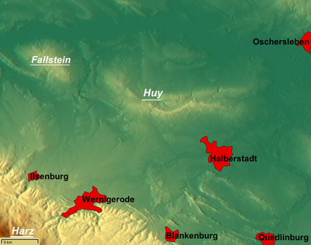
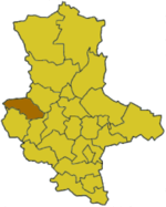
The Huy (pronounced [hyː], from the Old High German for Höhe = "heights") or Huywald is a ridge, up to 314.8 metres high, in western Saxony-Anhalt in Germany. It lies in the northern part of the district of Harz, about 10 kilometres northwest of Halberstadt and a few kilometres west of Schwanebeck. It is chiefly composed of bunter sandstone and muschelkalk and has been designated a protected area. Towards the north and northwest the terrain falls away into the Großes Bruch. Towards the east the Huy transitions to the Magdeburg Börde; to the south and southwest it is adjoined by the Harz Foreland and the Harz Mountains. The highest hill, the 314-metre-high Buchenberg, is located about three kilometres southwest of Dingelstedt am Huy, within the municipality of Huy. The Huy Forest (Huywald) is one of the largest, almost pure beech forests of central Europe. On the crest of the Huy lies the Benedictine abbey of Huysburg, which is on the Romanesque Road, and Daneil's Cave. Politically the Huy belongs to the parish of the same name. Its villages lie around the ridge itself.
Excerpt from the Wikipedia article Huy (hills) (License: CC BY-SA 3.0, Authors, Images).Huy (hills)
Warteberg, Huy
Geographical coordinates (GPS) Address Nearby Places Show on map
Geographical coordinates (GPS)
| Latitude | Longitude |
|---|---|
| N 51.955 ° | E 10.973055555556 ° |
Address
Herrenberg und Vorberg im Huy
Warteberg
38838 Huy (Dingelstedt)
Saxony-Anhalt, Germany
Open on Google Maps


