Holmens Kanal
Former canals in CopenhagenStreets in Copenhagen

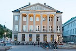
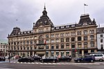
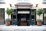
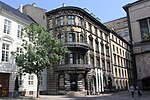
Holmens Kanal is a short street in central Copenhagen. Part of the main thoroughfare of the city centre, it extends from Kongens Nytorv for one block to a junction with a statue of Niels Juel where it turns right towards Holmens Bro while the through traffic continues straight along Niels Juels Gade. The street was originally a canal, hence the name, but was filled in the 1860s. Today it is dominated by bank and government buildings.
Excerpt from the Wikipedia article Holmens Kanal (License: CC BY-SA 3.0, Authors, Images).Holmens Kanal
Holmens Kanal, Copenhagen Christianshavn
Geographical coordinates (GPS) Address Nearby Places Show on map
Geographical coordinates (GPS)
| Latitude | Longitude |
|---|---|
| N 55.6778 ° | E 12.5858 ° |
Address
Holmens Kanal 10B
1060 Copenhagen, Christianshavn
Capital Region of Denmark, Denmark
Open on Google Maps


