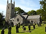
Jacobstow
Jacobstow (Cornish: Lannjago) is a civil parish and village in north Cornwall, England, United Kingdom. The village is located east of the A39 road approximately seven miles (11 km) south of Bude.Penhallym in the north of the parish is mentioned (as Penhalun) in the Domesday Book; nearby is Penhallam, site of a medieval manor. The name Jacobstow originates from Saxon times and derives from St James (Latin Jacobus) and holy place. As well as the church town, other settlements in the parish include Southcott and those parts of Canworthy Water north of the River Ottery. Jacobstow parish is on high ground and is entirely rural in character. It is bounded to the northwest by Poundstock parish, to the east by Week St Mary parish, to the west by St Gennys parish, and to the south by Warbstow parish. The southwest boundary of the parish follows the River Ottery for approximately two miles.The parish is in the Stratton Registration District and had a population of 421 at the 2001 census.
Excerpt from the Wikipedia article Jacobstow (License: CC BY-SA 3.0, Authors).Jacobstow
School Lane,
Geographical coordinates (GPS) Address Nearby Places Show on map
Geographical coordinates (GPS)
| Latitude | Longitude |
|---|---|
| N 50.734 ° | E -4.555 ° |
Address
School Lane
EX23 0BT
England, United Kingdom
Open on Google Maps


