West Lydford

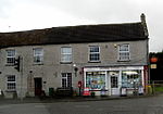
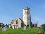
West Lydford is a village in Somerset, within the parish of Lydford on Fosse. The village is spread along a stretch of road called the High Street. At the north end of the village is a distinct group of houses known as Fair Place, on the site of a medieval fair.There are two old weirs in the area of the village, the larger, downstream, of which was refurbished in 2012 and provides a pool which is used for Open water swimming. The upstream weir was earlier lowered from its original height to prevent flooding on the A37, where the road crosses the River Brue. The village is the site for the Lydford on Fosse parish hall, which is situated adjacent to the Church.The current road bridge taking the High Street over the River Brue was built in the 17th century.
Excerpt from the Wikipedia article West Lydford (License: CC BY-SA 3.0, Authors, Images).West Lydford
Mardi's Lane,
Geographical coordinates (GPS) Address Nearby Places Show on map
Geographical coordinates (GPS)
| Latitude | Longitude |
|---|---|
| N 51.0829 ° | E -2.6249 ° |
Address
Mardi's Lane
Mardi's Lane
TA11 7ET , Lydford-on-Fosse
England, United Kingdom
Open on Google Maps


