Entremont (oppidum)

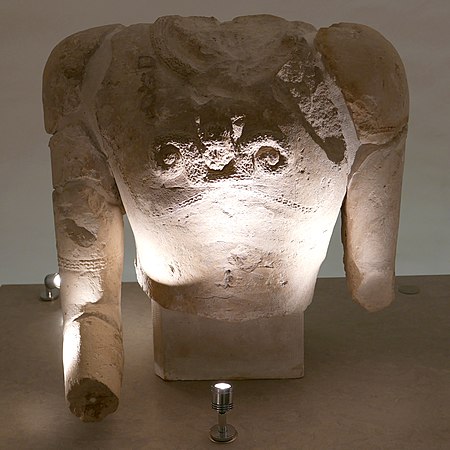
Entremont is a 3.5-hectare (8.6-acre) archaeological site three kilometres from Aix-en-Provence at the extreme south of the Puyricard plateau. In antiquity, the oppidum at Entremont was the capital of the Celtic-Ligurian confederation of Salyes. It was settled between 180 and 170 B.C., somewhat later than the inhabitation of other oppida, such as Saint-Blaise (7th to 2nd centuries B.C.). The site was abandoned when it was taken by the Romans in 123 B.C. and replaced by Aquae Sextiae (modern Aix-en-Provence), a new Roman city founded at the foot of the plateau. By 90 B.C., the former oppidum was completely uninhabited. The site contains two distinct areas of settlement surrounded by ramparts. Archaeologist Fernand Benoit named the older area, on the summit, "Ville Haute", and the lower "Ville Basse". Subsequently, it was recognised that the latter was an enlargement of the former, and they are now labelled "Habitat 1" and "Habitat 2", respectively.Finds from the site are displayed at Musée Granet and include statues, bas-reliefs and impressive severed heads.
Excerpt from the Wikipedia article Entremont (oppidum) (License: CC BY-SA 3.0, Authors, Images).Entremont (oppidum)
Avenue Fernand Benoit, Aix-en-Provence Saint-Eutrope
Geographical coordinates (GPS) Address Website External links Nearby Places Show on map
Geographical coordinates (GPS)
| Latitude | Longitude |
|---|---|
| N 43.552222 ° | E 5.4391666 ° |
Address
Oppidum d'Entremont
Avenue Fernand Benoit
13626 Aix-en-Provence, Saint-Eutrope
Provence-Alpes-Côte d'Azur, France
Open on Google Maps


