place

Bakewell

BakewellCivil parishes in DerbyshireDerbyshire DalesMarket towns in DerbyshireOpenDomesday
Pages with Gutenberg book template using bulletTowns and villages of the Peak DistrictTowns in DerbyshireUse British English from February 2021
Floral roundabout, Bakewell geograph.org.uk 1407646

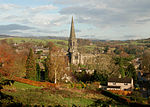
Bakewell is a market town and civil parish in the Derbyshire Dales district of Derbyshire, England, known for Bakewell pudding. It lies on the River Wye, 15 miles (23 km) south-west of Sheffield. At the 2011 census, the population of the civil parish was 3,949. It was estimated at 3,695 in 2019. The town is close to the tourist attractions of Chatsworth House and Haddon Hall.

Excerpt from the Wikipedia article Bakewell (License: CC BY-SA 3.0, Authors, Images).

Bakewell
Bath Street, Derbyshire Dales

Geographical coordinates (GPS) Address Nearby Places
placeShow on map

Wikipedia: BakewellContinue reading on Wikipedia

Geographical coordinates (GPS)

Latitude Longitude
N 53.214 ° E -1.676 °
placeShow on map

Address

Bath Street

Bath Street
DE45 1BX Derbyshire Dales
England, United Kingdom
mapOpen on Google Maps

Floral roundabout, Bakewell geograph.org.uk 1407646
Share experience

Nearby Places

Bakewell Castle
Bakewell Castle

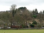
Bakewell Castle was in the town of Bakewell, Derbyshire (grid reference SK221688). It was a motte and bailey castle. According to some sources it was built in the year 924 by Edward the Elder, who also established the main burh. The purpose of its erection appears to have been as a measure against the Mercian invasion. According to the Anglo-Saxon Chronicle, Edward marched into peakland after he had fortified Nottinghamshire, and from there onward he arrived at Bakewell, and commanded that a town with a garrison be established at this location. According to other sources the castle was built in the 12th century, most probably by Ralf Gernon. According to these sources, the building that existed before the 12th century at this location was not a fortification, but a simple manor, which was awarded to Gernon by Richard I during the 12th century, and Gernon fortified the manor. This hypothesis is based on the views of M.J. Swanton, formed after their 1969 and 1971 excavations of the location which showed that the remains of pottery found in the south-eastern side of the bailey were most probably from the 12th or 13th century. Some recent sources have suggested that both theories could be correct: that the castle is a 12th-century motte built upon a Saxon burh.The castle was razed to the ground during the English Civil War. Today the only ruins that remain are certain earthworks, atop a mound that has been named as Castle Hill. The motte, which at one time may have been further fortified with a timber palisade, and its two baileys are visible, but none of the buildings remain except some foundation walls, which are now covered with vegetation; otherwise, only the earthworks remain. It is a Scheduled Ancient Monument.