place

Millendreath

Cornwall geography stubsHamlets in CornwallLooe
Millendreath Beach geograph.org.uk 310766

Millendreath is a hamlet in the parish of Looe, Cornwall, England, situated two miles east of the town of Looe.A station was to be built at Millendreath as part of the proposed St Germans & Looe Railway in the late 1930s, but the railway was abandoned without the station having been built. An associated golf course was constructed, but it was abandoned on the outbreak of war.

Excerpt from the Wikipedia article Millendreath (License: CC BY-SA 3.0, Authors, Images).

Millendreath
May Lane,

Geographical coordinates (GPS) Address Nearby Places
placeShow on map

Wikipedia: MillendreathContinue reading on Wikipedia

Geographical coordinates (GPS)

Latitude Longitude
N 50.3627489 ° E -4.4366017 °
placeShow on map

Address

May Lane
PL13 1NY , St. Martin-by-Looe
England, United Kingdom
mapOpen on Google Maps

Millendreath Beach geograph.org.uk 310766
Share experience

Nearby Places

St Martin-by-Looe
St Martin-by-Looe

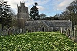
St Martin-by-Looe (Cornish: Penndrumm) is a coastal civil parish in south Cornwall, England, United Kingdom. The parish is immediately east of the town and parish of Looe, seven miles (11 km) south of Liskeard. The parish is in the Liskeard Registration District and the population in the 2001 census was 321, which had increased to 429 at the 2011 census.To the north, the parish is bordered by Morval parish, to the east by Deviock parish, to the west by Looe parish and to the south by the English Channel. Until 1845 the parish also included East Looe. The parish church of St Martin stands outside the civil parish in the hamlet of St Martin at OS Grid Ref SX259550 about a mile north of Looe town centre. Its Norman doorway is built of Tartan Down stone and probably dates from about 1140. The interior of the church is of typically 15th-century appearance, but parts of the building are considerably older.Thomas Bond, the topographer is buried in the churchyard. Jonathan Toup, classical scholar, was presented on 28 July 1750 to the rectory of St Martin and held it until his death in 1785. A stone cross was found at Tregoad Farm in 1906 built into the wall of a stable. In 1931 it was set up on a new base at Tregoad by the Looe Old Cornwall Society. In 1971 it was removed to the Guildhall Museum in East Looe for preservation. It is a rare example in east Cornwall of a cross with a carved figure of Christ, in this case incised.