Hatt, Cornwall
Caradon geography stubsUse British English from January 2016Villages in Cornwall

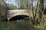
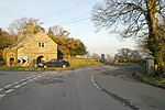
Hatt is a hamlet in the civil parish of Botusfleming in east Cornwall, England, UK. It is on the A388 road from Callington to Saltash. Hatt House was built of red brick in about 1720 and is of two and a half storeys. The hamlet's main community area is situated at the Hatt Roundabout, with a petrol station and a playing field nearby as well as a 'bus stop providing travel to Callington, Launceston, Saltash and Plymouth.
Excerpt from the Wikipedia article Hatt, Cornwall (License: CC BY-SA 3.0, Authors, Images).Hatt, Cornwall
Sunnybanks,
Geographical coordinates (GPS) Address Nearby Places Show on map
Geographical coordinates (GPS)
| Latitude | Longitude |
|---|---|
| N 50.436 ° | E -4.261 ° |
Address
Sunnybanks
Sunnybanks
PL12 6PN , Botusfleming
England, United Kingdom
Open on Google Maps


