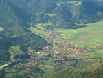
Reit im Winkl is a small village (locally known as a snow-magnet) located on the German/Austrian border in the southeastern part of Bavaria, Germany. Part of the Traunstein district, it was previously an immigration and customs control point (prior to the formation of the Schengen Zone). It is situated south of Chiemsee and southwest of Ruhpolding – home of the Biathlon World Cup – in the Bavarian Alps and facing towards Tyrol. The village lies next to the Austrian states Tyrol and Salzburg. Kössen in Tyrol is the next village on the river Lofer, before it joins the confluence of the river Tiroler Achen. Reit im Winkl has a population of approximately 2,600.
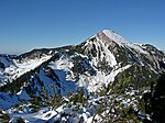
Reit im Winkl is well known as both a certified place of restorative and curative air (Luftkurort) and a ski resort, offering alpine skiing, cross-country skiing, both classical and skating, and snow-boarding, as well as mountain trekking and hiking. It achieved, in 2012, Germany's first-ever Premium Winter Trails Certification. Snowfall is always plentiful and predictable (even when surrounding areas are bare of snow, Reit im Winkl can be sure of sufficient snow to create premier skiing conditions – in 2012 Reit im Winkl had the deepest snow of 120 cm for a plateau area, which occurred in February, long after snow had melted elsewhere in the region. Reit im Winkl has two alpine skiing areas: 1) Three lifts in the suburb of Blindau (Benzeck) as well as a snow-tubing lift, and the large plateau skiing area at Winklmoos Alm which connects with Steinplatte in Austria and is reached by the recently completed, state-of-the-art gondola cableway (bubble lift) from Seegatterl.
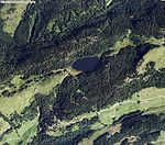
In summer, Reit im Winkl enjoys one of the highest counts of sunny days in Bavaria, and is popular with mountain bike and nordic walking enthusiasts. Visitors can enjoy swimming in either of the three alpine lakes (Weitsee, Mittersee and Loedensee) northeast of Seegatterl, or try their luck at fishing in the trout lake.
Reit im Winkl is popularly known to locals and return visitors as Germany's own Tyrol, and boasts its own home-grown regional specialities such as Heumilch cheese (cheese made from cows fed exclusively hay pasture), heuschnapps (a liqueur in which mountain hay and herbs are soaked to produce a distinctive and sweet taste of hay) and Reiberdatschi (grated potatoes mixed with a little egg and flour and poured as a flat mass into a skillet and fried), popularly eaten with apple mousse.


