Bethel, Eugene, Oregon
Neighborhoods in Eugene, Oregon
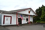
Bethel-Danebo, most commonly referred to as Bethel, is a neighborhood of west Eugene, Oregon, United States. The neighborhood boundaries are Oregon Route 99 on the east, the former Southern Pacific Coos Bay Line on the south, Green Hill Road on the west and Clear Lake Road on the north.The neighborhood combines the names of two historic communities. The original location of Bethel is now within the Trainsong neighborhood.Bethel School District is separate from the main Eugene school district.
Excerpt from the Wikipedia article Bethel, Eugene, Oregon (License: CC BY-SA 3.0, Authors).Bethel, Eugene, Oregon
Catalina Street, Eugene
Geographical coordinates (GPS) Address Nearby Places Show on map
 Continue reading on Wikipedia
 Geographical coordinates (GPS)
| Latitude | Longitude |
|---|---|
| N 44.078707 ° | E -123.171844 ° |
Address
Catalina Street 4485
97402 Eugene
Oregon, United States
Open on Google Maps