place

Rockville High School (Maryland)

1968 establishments in MarylandEducational institutions established in 1968International Baccalaureate schools in MarylandPublic high schools in Montgomery County, MarylandSchools in Rockville, Maryland
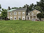
Rockville High School main entrance Rockville MD MCPS 2021 07 03 100343 1 crop

Rockville High School (RHS) is a four-year high school in Rockville, Maryland, United States. The school was founded in 1968, and its current building was completed in August 2004. Rockville High School is based in Montgomery County, Maryland. In 2019, enrollment was 1,440 students. Earle B. Wood Middle School is the only feeder school for RHS. The original building underwent renovation starting in the 2002–2003 school year, and was completed by the start of the 2004–2005 school year. During the two years of renovation, RHS students attended Northwood High School.

Excerpt from the Wikipedia article Rockville High School (Maryland) (License: CC BY-SA 3.0, Authors, Images).

Rockville High School (Maryland)
Baltimore Road, Rockville

Geographical coordinates (GPS) Address Website External links Nearby Places
placeShow on map

Wikipedia: Rockville High School (Maryland)Continue reading on Wikipedia

Geographical coordinates (GPS)

Latitude Longitude
N 39.085396 ° E -77.117693 °
placeShow on map

Address

Rockville High School

Baltimore Road 2100
20851 Rockville
Maryland, United States
mapOpen on Google Maps

Website
montgomeryschoolsmd.org

linkVisit website

linkWikiData (Q7355639)
linkOpenStreetMap (843360975)

Rockville High School main entrance Rockville MD MCPS 2021 07 03 100343 1 crop
Share experience

Nearby Places

Red Gate Park
Red Gate Park

RedGate Park is a wooded public park in suburban Rockville, Maryland, which is 131 acres of natural green space situated between Maryland Route 28, parts of Rock Creek Regional Park, and Avery Road. It is administered by the Rockville, Maryland government as a public park and nature preserve. The park began as a public golf course, called RedGate Golf Course, which was designed and built in 1974. It operated until 2018, when it was converted into a public park as part of a unanimous vote to keep the land undeveloped, after a $3.2 million estimation for necessary repairs compelled the management company, Billy Casper Golf, a golf course management company located in Reston, Virginia, to terminate its 10-year lease three years early, opening up the possibility for redevelopment or preservation. Rockville local government hosted information and input sessions to determine the most suitable use of the land. The park still retains the asphalt paths suited to golf carts, and many of the fixtures and structures that are common to a golf course, but the course itself has largely been absorbed by natural reclamation. This follows a recent trend of declining popularity for the sport of golf, and an increased desire for green space. In March 2020, the city of Rockville voted unanimously to retain the entirety of the 131-acre park as a public nature preservation area. The park is now a habitat to 170 species of native Maryland birds and serves as an open space with adjacent forests for these birds, which is needed for their feeding habits. The Friends of Redgate Park organization claims that the park is now home to 166 identified bird species. Other animals frequenting the park include deer and fox. In August 2019, Cornell's Ornithology designated the site as a "Birding Hotspot", on their website, eBird. Filmmaker Cintia Cabib is producing a documentary entitled Bird Walk which focuses on the birds and birders at RedGate Park and on the grassroots campaign which advocated that the defunct golf course be transformed into a public park. A city-approved master plan was submitted that would transform the mostly-wild green space into a developed multi-use park, with such amenities including a new visitor center, a dog park, community gardens, an amphitheater, a new parking lot, new road connections, a playground, a picnic area, and other improvements. The plan has since been pared down and the park will retain its passive recreational use except for the community gardens. RedGate Park is a grassland habitat, dotted with man-made water features and mature trees that were installed during its time as a golf course. The park is adjacent to the National Park Service's Rock Creek Trail system, though currently there is no pedestrian or bicycle path connection between the two.

Lake Bernard Frank
Lake Bernard Frank

Lake Bernard Frank (also Lake Frank), is a 54-acre (220,000 m2) reservoir on the North Branch of Rock Creek in Derwood, Maryland, U.S., just east of Rockville. In the late 1960s it was renamed after Bernard Frank, a wilderness activist and a co-founder of The Wilderness Society. The lake's boundaries are, approximately, Route 28, East Gude Drive, Avery Road, and Muncaster Mill Road. Lake Frank was created in 1966 as Lake Norbeck to aid in flood and sediment control, as well as to provide recreation. It has an earthen dam, installed in 1967, on its southern side. It was created as a sister lake to Lake Needwood. Lake Frank is owned by the Maryland-National Capital Park and Planning Commission (M–NCPPC). The lake's secluded location within Rock Creek Regional Park is another of its assets. Visitors to the lake must bike or walk about 1/4 of a mile from all parking lots to get to the lakeshore. The Lake Frank & Meadowside Trails surround the lake, making it a favorite hiking spot. Also, locals enjoy fishing from the shoreline, though a license is needed to do so. However, swimming, boating, and ice skating are prohibited.The main trail around Lake Frank, the Lakeside Trail, is a 31⁄4 mile long loop. Approximately 2/3 of the trail is unpaved and traverses the woods surrounding the lake. The other part of the trail is wider and paved. At the approximate half-way point of the trail, there is a creek that must be crossed. Though there are a group of rocks which form a bridge-like path across, the creek may be impassable depending on the water level.