place

Boconnoc

Civil parishes in CornwallSites of Special Scientific Interest in CornwallSites of Special Scientific Interest notified in 1977Use British English from October 2012
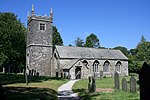
Boconnoc Church, Boconnoc Estate geograph.org uk 3559781

Boconnoc (Cornish: Boskennek) is a civil parish in Cornwall, England, United Kingdom, approximately four miles (6 km) east of the town of Lostwithiel. According to the 2011 census the parish had a population of 96. The parish is rural in character and is fairly well wooded. It is bordered to the west by St Winnow parish, to the south by St Veep parish, to the southeast and east by Lanreath parish, and to the north by Braddock parish. The hamlets of Couch's Mill and Brooks are in the parish. Part of ancient deer park at Boconnoc House contains an internationally important assemblage of lichens and is one of the most important sites in Europe for lichens.

Excerpt from the Wikipedia article Boconnoc (License: CC BY-SA 3.0, Authors, Images).

Geographical coordinates (GPS)

Latitude Longitude
N 50.416 ° E -4.611 °
placeShow on map

Address

A390
PL22 0LN
England, United Kingdom
mapOpen on Google Maps

Boconnoc Church, Boconnoc Estate geograph.org uk 3559781
Share experience

Nearby Places

A390 road
A390 road

The A390 is a road in Cornwall and Devon, England. It runs from Tavistock to 5 miles (8.0 km) north west of the city of Truro. Starting in Tavistock, it heads south-westwards towards Liskeard, crossing over the River Tamar and into Cornwall, then through Gunnislake and Callington. Immediately before Liskeard, it merges with the A38 north of the town. It diverges from the A38 at Dobwalls, where it then runs in a south-westerly direction to Truro via Lostwithiel, St. Blazey, and St Austell. It then forms an upside down elongated square loop, and bypasses Truro City Centre. It then heads north west out of the city, where it forms the main corridor into Truro from the west. It passes the Royal Cornwall Hospital and skirts the village of Threemilestone, before linking up with the A30 road at Chiverton Cross, where the A390 terminates. Chiverton Cross is where the A390 trunk road from Truro and the B3277 to St Agnes meet the east–west A30 trunk road. Before the A390 was rerouted away from Chacewater it ended at its junction with the A30 at Scorrier. It forms part of the main route (the Truro to Dobwalls section) from Truro to Plymouth, although after a severe accident in Lostwithiel in 1999 heavy goods vehicles are diverted from it at the top of Edgcumbe Road, Lostwithiel. By far the busiest section of the road is known as Truro Road between Truro City Centre and Chiverton Cross, where it carries through traffic to West Cornwall, as well as commuting traffic to and from Truro, and traffic for the Royal Cornwall Hospital, Truro College and the Richard Lander School. There are many residential new housing estates in this area which have created further traffic. The section from Truro College heading into Truro from the west also includes a Bus lane and some dual carriageway sections.