place

Saint David's Buried Gorge

Canyons and gorges of OntarioFormer riversGlaciology of Canada

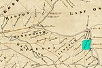
Saint David's Buried Gorge is an ancient pre-glacial river bed that existed 22,800 years ago on the present-day Niagara Peninsula. The ancient Saint David's River once flowed through this area prior to the advance of the Wisconsin glaciation during the Last Glacial Period. When the glacier retreated 12,000 years ago, the gorge and river valley were filled in with glacial silt and rocks. Approximately 4,200 years ago, the Niagara River intersected the buried gorge in the course of Niagara Falls receding toward Lake Erie. When the river encountered the glacial silt that filled the gorge, the river rapidly changed course to fill the ancient gorge and wash out most of the silt. This led to the formation of the Niagara Whirlpool. The Niagara River reclaimed the gorge and currently flows through part of the ancient gorge. The other part of the ancient gorge extends into Lake Ontario at a different point than the Niagara River. The gorge is estimated to be 4,000 ft (1,200 m) long, 1,000 ft (300 m) wide, and 300 ft (91 m) deep. In the 1950s, Ontario Hydro dug two tunnels from the upper Niagara River to supply water to the Sir Adam Beck Hydroelectric Plant. These tunnels had to surface when they encountered the St. David's Gorge, as the loose silt in it was unsuitable for tunneling. In 2013, an additional tunnel, the Niagara Tunnel Project, was completed. This tunnel was bored beneath the old gorge to avoid the unsuitable geology.

Excerpt from the Wikipedia article Saint David's Buried Gorge (License: CC BY-SA 3.0, Authors).

Saint David's Buried Gorge
Melrose Drive,

Geographical coordinates (GPS) Address Nearby Places
placeShow on map

Wikipedia: Saint David's Buried GorgeContinue reading on Wikipedia

Geographical coordinates (GPS)

Latitude Longitude
N 43.15 ° E -79.098 °
placeShow on map

Address

Melrose Drive 37
L0S 1P0
Ontario, Canada
mapOpen on Google Maps

Share experience

Nearby Places

Stamford Township
Stamford Township

Stamford Township is a former incorporated and now geographic township in Upper Canada, later Ontario, on the Niagara Peninsula. It was originally designated Township #2 in the Home District of the Quebec Colony in Canada. Following the creation of Upper Canada in 1791, Township #2 was renamed Stamford and placed within the newly created County of Lincoln. When Lincoln county was divided into Lincoln (north) and Welland (south) counties in 1851, Township #2 was placed in Welland County. The first survey took place around 1776, during the American Revolutionary War. Twelve European-American families came to settle in the area, including the Cooks and Durhams from New Jersey. It was developed and settled initially by Loyalists, primarily from New York State and other areas of the British colonies with the first two settlers being the Thomas McMicking and Philip Bender families. and later the Thompson and Bastedo families, among numerous others. The British Crown granted land to Loyalists in Upper Canada to compensate them for their losses in the Revolution and to settle this area. As the second township in the region surveyed, it was named Township #2, and sometimes referred to as Mount Dorchester for Sir Guy Carleton Lord Dorchester. Another survey was conducted in 1787, following the United States achieving independence. The area was named Stamford in 1787 by John Graves Simcoe, the first Lieutenant Governor of Upper Canada, as the largest area in the township was already known as Stamford Village, It was given royal status in 1791. New settlers were initially mostly ethnic British, although some from New York also had more distant Dutch, Mohawk and French ancestry. The first municipal government was established in 1793. Its first two Wardens were John Wilson and Thomas McMicking.Stamford Village was the largest community in the township, dating back to 1783. Although as a village it had no formal municipal government or status, it was referred to as Stamford, apparently after Stamford Village in Delaware County in New York where some pioneers originally settled. The building of the Stamford Meeting House took place in 1787 next to the local cemetery which villagers called God's Half Acre. This Meeting House became the Stamford Presbyterian Church, the first Presbyterian Church in Upper Canada (circa 1844). In 1962 the township was amalgamated with the city of Niagara Falls, Ontario.

Niagara Gorge
Niagara Gorge

Niagara Gorge is an 11 km (6.8 mi) long canyon carved by the Niagara River along the Canada–United States border, between the U.S. state of New York and the Canadian province of Ontario. It begins at the base of Niagara Falls and ends downriver at the edge of the geological formation known as the Niagara Escarpment near Queenston, Ontario, where the falls originated about 12,500 years ago. The position of the falls has receded upstream toward Lake Erie because of the falling waters' slow erosion of the riverbed's hard Lockport dolomite (a form of limestone that is the surface rock of the escarpment), combined with rapid erosion of the relatively soft layers beneath it. This erosion has created the gorge. The force of the river current in the gorge is one of the most powerful in the world; because of the dangers this presents, kayaking the gorge has generally been prohibited. On multiple occasions, the rapids of the gorge have claimed the lives of people attempting to run them. However, on isolated occasions, world-class experts have been permitted to navigate the stretch. Tourists can traverse the rapids of the Niagara Gorge on commercial tours in rugged jetboats, which are based at Niagara-on-the-Lake, Ontario, at Lewiston, New York, at Youngstown, New York, and in midsummer at Niagara Glen Nature Centre on the Niagara Parkway in Ontario.Matthew Webb, the first person to swim the English Channel, drowned trying to swim the rapids of the gorge as part of a publicity stunt in 1883.