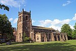
Huntington, Staffordshire
AC with 0 elementsCannock ChaseSouth Staffordshire DistrictVillages in Staffordshire

Huntington is a civil parish and former mining village in Staffordshire, on the outskirts of Cannock Chase. It lies on the A34 road just north of Cannock and is surrounded by woodland. The village had an estimated population of 3,720 in 2004, increasing to 4,536 at the 2011 Census.
Excerpt from the Wikipedia article Huntington, Staffordshire (License: CC BY-SA 3.0, Authors, Images).Huntington, Staffordshire
Cocksparrow Lane, South Staffordshire Huntington
Geographical coordinates (GPS) Address Nearby Places Show on map
Geographical coordinates (GPS)
| Latitude | Longitude |
|---|---|
| N 52.715 ° | E -2.042 ° |
Address
Cocksparrow Lane
Cocksparrow Lane
WS12 4PB South Staffordshire, Huntington
England, United Kingdom
Open on Google Maps


