Mozhaysky District, Moscow

Mozhaysky District (Russian: Можа́йский райо́н) is a territorial division (a district, or raion) in Western Administrative Okrug, one of the 125 in the federal city of Moscow, Russia. It is located in the west of the federal city. The area of the district is 17.526 square kilometers (6.767 sq mi). As of the 2010 Census, the total population of the district was 132,373. Mozhaysky District takes its name after Mozhayskoe Highway, the district's major road, which in turn was named after the old Mozhayskaya road which lead to Mozhaysk town, located 110 kilometers (68 mi) to the west of Moscow, which was protecting west approach routes to Moscow since 13th century.From 1 July, 2012, the district also includes the territory of the Skolkovo Innovation Center. As a municipal division, the district is incorporated as Mozhaysky Municipal Okrug.
Excerpt from the Wikipedia article Mozhaysky District, Moscow (License: CC BY-SA 3.0, Authors, Images).Mozhaysky District, Moscow
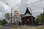
Можайское шоссе (дублёр), Moscow Mozhaisky
Geographical coordinates (GPS) Address Phone number Website Nearby Places Show on map
 Continue reading on Wikipedia
 Geographical coordinates (GPS)
| Latitude | Longitude |
|---|---|
| N 55.716666666667 ° | E 37.4 ° |
Address
Храм Святителя Иова, Патриарха Московского и всея Руси
Можайское шоссе (дублёр) 56
121596 Moscow, Mozhaisky
Moscow, Russia
Open on Google Maps
Phone number
Website
svt-iov.ru