place

Sant Sebastià de la Guarda

Museums in Baix Empordà

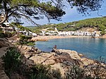
The historical site of Sant Sebastià de la Guarda is located in town of Llafranc in the Baix Emporda region of Girona province. The site consists of an Iberian archeological site from the 6th-1st centuries B.C., a 15th-century watchtower and a 19th-century lighthouse on top of a small mountain 156m above the sea (to protect and defend the region from pirate attacks, and which still retains many of its original features).The tower allows for panoramic views of the Costa Brava coastline and contains a small museum that details the history of the monument and Llafranc area. The archeological site consists of a small Iberian village which was first discovered between 1958–1960, with excavations taking place between 1984-1987.

Excerpt from the Wikipedia article Sant Sebastià de la Guarda (License: CC BY-SA 3.0, Authors).

Sant Sebastià de la Guarda
Camí de Ronda,

Geographical coordinates (GPS) Address Nearby Places
placeShow on map

Wikipedia: Sant Sebastià de la GuardaContinue reading on Wikipedia

Geographical coordinates (GPS)

Latitude Longitude
N 41.8971 ° E 3.2029 °
placeShow on map

Address

Camí de Ronda

Camí de Ronda
17211
Catalonia, Spain
mapOpen on Google Maps

Share experience

Nearby Places

Llafranc
Llafranc

Llafranc (Catalan pronunciation: [ʎəˈfɾaŋ]) is one of three coastal towns belonging to the municipality of Palafrugell, province of Girona, Spain, the other two being Calella de Palafrugell and Tamariu. It is part of the Costa Brava, the coastal region of northeastern Catalonia, in the comarca of Baix Empordà.Many domestic tourists come from nearby Barcelona, while the international tourists come from a whole range of countries, especially the Netherlands, England, France, and more recently the United States. The Hotel Llafranc dominates the main sea promenade and was popular with artists such as Rock Hudson, Sophia Loren, Elizabeth Taylor, Salvador Dalí and Ernest Hemingway. The English writer Tom Sharpe was also a resident of Llafranc.The town is overlooked by the historical site of Sant Sebastià de la Guarda, located on a headland 1.5 kilometres (0.93 mi) to the north, and 168 metres (551 ft) above, Llafranc beach. It comprises the ruins of a settlement of the Iberians from the 6th-1st centuries BCE, a 15th-century watchtower and the 19th century Sant Sebastià lighthouse. The lighthouse, which is still operational, has a range of 32 nautical miles (59 km; 37 mi) and is the most powerful on the Catalan coast. The residential district of El Far, which takes its name from the lighthouse, lies below the headland.The GR 92 long distance footpath, which runs the length of the Mediterranean coast of Spain, passes through the town. To the north the path follows the road up to the lighthouse and then uses an in places rough, track above the shore line to the beach at Cala Pedrosa and the town of Tamariu. To the south the path follows the coast the short distance to Calella de Palafrugell, passing the 16th century Torre de Calella on the way.Commerce and civic organizations gather under the Associació d'Amics de Llafranc, which elects a president every 4 years in order to represent this small town in the City Council of Palafrugell, its main municipality.

Calella de Palafrugell

Calella de Palafrugell is one of three coastal towns belonging to the municipality of Palafrugell in the province of Girona, Spain. The other two towns are Llafranc, only one kilometre (0.62 mi) to the north, and Tamariu, some four kilometres (2.5 mi) to the north. All three towns are part of the Costa Brava, the coastal region of northeastern Catalonia, in the comarca of Baix Empordà. It should not be confused with the larger, more commercialised resort of Calella, which is further south towards Barcelona, in the comarca of Maresme.Calella de Palafrugell has an excellent setting and, whilst busy in the summer season, it does not have the large hotels and mass tourism of other Costa Brava resorts such as Lloret de Mar. The town has a number of good standard hotels, apartments and, at a distance from the beach, some campsites. Like much of the picturesque section of the Costa Brava, north of Palamos and south of L'Estartit, Calella has moved steadily upmarket in recent times and offers some very high quality restaurants and hotels - at prices to match. The beaches are Blue Flag standard. Calella de Palafrugell is a very popular destination dominated by apartments blocks set just back enough not to be seen from the beach.The town's origin is that of a fishing village, and its old maritime quarter, the Port Bo has been declared a cultural asset of national importance. This quarter retains the original layout of the village, with its traditional white porched buildings. It includes the complex of vaults, originally used to sew nets and auction fish, but now occupied by restaurants. The vaults are fronted by the beaches of Platja del Port de Malaspina and Platja de Portbò, which formed a natural fishing port and are still home to a fleet of small fishing boats. Also in Port Bo is the Sa Perola Interpretation Centre, housed in a former net dyeing house and now used as a tourist office and interpretation centre for the fishing industry and maritime heritage of the district.Calella de Palafrugell has a number of small coves and beaches linked via a well engineered coastal walk known as the Cami de Ronda, passing along the cliffs and through several tunnels on the way. From the north the first of the beaches is Platja del Canadell, with its beach restaurant. Platja del Port de Malaspina, Platja de Portbò and Platja d'en Calau are linked sandy coves located in the centre of Calella. These are followed by Platgeta d'en Cosme, Platje de Port Pelegri, Platja de Sant Roc and Platja del Golfet, the last of which is approximately 1.5 kilometres (0.93 mi) from central Calella.Beyond Platja del Golfet is the Cap Roig headland, where the Castell de Cap Roig is situated, surrounded by large botanical gardens. The castle has also been declared a cultural asset of national importance. The castle was built, and the gardens created, between 1929 and 1975, by Nicholas Woevodski and Dorothy Webster. The Cap Roig Festival, a music and dance festival, is held in the gardens between July and August.The GR 92 long-distance footpath, which runs the length of the Mediterranean coast of Spain, passes along the Cami de Ronda. To the north of Platja del Canadell the path follows the coast the short distance to Llafranc, passing the 16th century Torre de Calella on the way. To the south the path takes an inland route from Platja del Golfet, bypassing Cap Roig through pine and cork oak forests to the fisherman's village at S'Alguer and the beach at La Fosca.

Tamariu
Tamariu

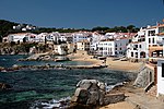
Tamariu (Catalan pronunciation: [təməˈɾiw], Catalan for tamarisk) is one of three coastal towns belonging to the municipality of Palafrugell, province of Girona, Spain, the other two being Calella de Palafrugell and Llafranc. It is part of the Costa Brava, the coastal region of northeastern Catalonia, in the comarca of Baix Empordà. It is situated about 70 mi (110 km) south of the border with France and close to the nearby inland towns of Palafrugell and Begur.The name Tamariu derives from the presence of many tamarisk trees along the promenade, which separates the beach from the narrow streets and whitewashed buildings of the town. Tamariu was originally a small fishing village, and fishing boats are still to be seen drawn up on the beach. Today they have been joined by a few hotels, along with seafood restaurants, cafes and bars.Tamariu is set amongst rugged pine covered cliffs flanking the Mediterranean Sea. The crystal clear waters around this area are amongst the purest on the coast. The south-facing blue flag beach is ideal for swimming as the it shelves at a fairly gentle angle. It is also popular as a dive site as there are many caves to explore along with the submerged mountain of the Llosa de Cala Nova.The GR 92 long distance footpath, which runs the length of the Mediterranean coast of Spain, passes through the town. To the north the path takes an inland route through pine and cork oak forests to the beach at Aiguablava before following the coast to Fornells. To the south the path follows an, in places rough, track above the shore line to the beach at Cala Pedrosa, the Sant Sebastià lighthouse, and the town of Llafranc.Aigua Gelida is the largest urbanisation in Tamariu filling the gap between Tamariu and Aiguablava. Aigua Gelida has a small sandy cove predominantly for residents of Cala Nostra just 300m away. Building restrictions are not as strict in Aigua Gelida and so many modern villas have been built in the past few years.

Battle of Les Formigues

The naval Battle of Les Formigues (Catalan) took place probably in the early morning of 4 September 1285 near Les Formigues Islands, Catalonia, about 85 km northeast of Barcelona, when a Catalan-Sicilian galley fleet commanded by Roger of Lauria defeated a French and Genoese galley fleet commanded by Guilhem de Lodeva, Henry di Mari, and John de Orrea. There are three almost completely different accounts of this battle: from Ramon Muntaner, Bernard Desclot, and the Gesta comitum Barchinonensium. The Gesta places the battle at Les Formigues (or Fomigas), while Muntaner favoured a location off Roses to the north. Either Lauria or the French were ashore for the night and encountered by the other, or they were both at sea when the encounter took place. The accounts agree that it happened at night, which was unusual for medieval naval battles, but suited Lauria who was skilled at night-fighting. He used two lanterns on each galley to increase his apparent numbers. Ten to sixteen Genoese galleys under John de Orreo fled, leaving about fifteen to twenty French galleys to be captured, and some others sunk or burnt.The troubadour Joan Esteve blamed treachery for the capture of the French admiral Guilhem. It is said that three hundred French prisoners were sent back to France. All of the prisoners but one had their eyes gouged out, and that one was left with one eye to guide the others. The prisoners brought one message from Roger of Lauria to the King of France: that not even fish would be able to navigate safely through Mediterranean Sea without a shield or sign of the king of Aragon on them.