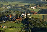
Trstenik, Šentrupert
Jugovzhodna Slovenija statistical region geography stubsPages with Slovene IPAPopulated places in the Municipality of Šentrupert

Trstenik (pronounced [təɾstɛˈniːk]) is a settlement in the Municipality of Šentrupert in southeastern Slovenia. It lies just northeast of Mirna in the historical region of Lower Carniola. The municipality is now included in the Southeast Slovenia Statistical Region. It includes the hamlets of Butara, Gorenji Konec (Slovene: Gorenji konec), Veliki Konec (Veliki konec), Kurja Dolina (Kurja dolina), Dolenji Konec (Doleji konec), Kot (German: Winkel), and Sotlo.
Excerpt from the Wikipedia article Trstenik, Šentrupert (License: CC BY-SA 3.0, Authors, Images).Trstenik, Šentrupert
Sotla,
Geographical coordinates (GPS) Address Nearby Places Show on map
Geographical coordinates (GPS)
| Latitude | Longitude |
|---|---|
| N 45.961194444444 ° | E 15.069405555556 ° |
Address
Sotla 29
8233
Slovenia
Open on Google Maps


