Stevens Creek (California)
Los Altos, CaliforniaMountain View, CaliforniaNative name checker template errorsRivers of Northern CaliforniaRivers of Santa Clara County, California ... and 3 more
Santa Cruz MountainsTourist attractions in Silicon ValleyTributaries of San Francisco Bay

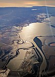
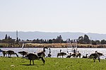
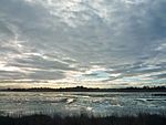
Stevens Creek is a creek in Santa Clara County, California. The creek originates in the Santa Cruz Mountains on the western flank of Black Mountain in the Monte Bello Open Space Preserve near the terminus of Page Mill Road at Skyline Boulevard. It flows southeasterly through the Stevens Creek County Park before turning northeast into Stevens Creek Reservoir. It then continues north for 12.5 miles through Cupertino, Los Altos, Sunnyvale and Mountain View before emptying into the San Francisco Bay at the Whisman Slough, near Google's main campus.
Excerpt from the Wikipedia article Stevens Creek (California) (License: CC BY-SA 3.0, Authors, Images).Stevens Creek (California)
Stevens Creek Trail,
Geographical coordinates (GPS) Address Nearby Places Show on map
Geographical coordinates (GPS)
| Latitude | Longitude |
|---|---|
| N 37.445833333333 ° | E -122.06361111111 ° |
Address
Stevens Creek Trail
Stevens Creek Trail
94035
California, United States
Open on Google Maps


