place

Simbach, Dingolfing-Landau

Dingolfing-LandauLower Bavaria geography stubsMunicipalities in Bavaria
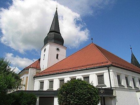
Pfarrkirche Simbach
Pfarrkirche Simbach

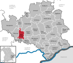
Simbach is a market town and municipality in the district of Dingolfing-Landau, Bavaria, Germany. As of 2020, it had a population of around 4,000 and an area of 51.23 km². Simbach consists of the market town of Simbach, 10 villages and more than 100 hamlets and isolated dwellings. The largest villages are Haunersdorf (in the north) and Ruhstorf (in the south). The area around Simbach is still characterized by agriculture. The largest employer is the Fleischer company, which produces canned vegetables.

Excerpt from the Wikipedia article Simbach, Dingolfing-Landau (License: CC BY-SA 3.0, Authors, Images).

Simbach, Dingolfing-Landau
Schlesierstraße,

Geographical coordinates (GPS) Address Nearby Places
placeShow on map

Wikipedia: Simbach, Dingolfing-LandauContinue reading on Wikipedia

Geographical coordinates (GPS)

Latitude Longitude
N 48.566666666667 ° E 12.75 °
placeShow on map

Address

Schlesierstraße 18
94436
Bavaria, Germany
mapOpen on Google Maps

Pfarrkirche Simbach
Pfarrkirche Simbach
Share experience

Nearby Places

Ruppertskirchen (Arnstorf)

Ruppertskirchen is a village in the municipality of Arnstorf in Rottal-Inn district in the province of Lower Bavaria in southern Germany. Ruppertskirchen lies on the Simbach stream between Arnstorf and Simbach bei Landau on state highway 2112. Before the regional reorganisation in Bavaria in 1972 Ruppertskirchen was an independent municipality with 42 subdivisions. At that time Ruppertskirchen was the largest municipality in present-day Markt Arnstorf and, in terms of area, the largest in the old district of Eggenfelden. It had a railway halt on the old Landau–Arnstorf railway. Ruppertskirchen itself has 9 houses, with just under 20 inhabitants, and a pub. The name goes back to Rueperskhürchen (settlement near the Church of St. Rupert) mentioned as early as 1614. The church in Ruppertskirchen, like the village, is named in honour of St. Rupert. Its predecessor, a late Roman structure, was built in the 13th century and was originally called St. Lampertus. The road through Ruppertskirchen is named after the last mayor of the municipality of Ruppertskirchen, Peter Huber from Siegerstorf. The following villages belonged to the former municipality of Ruppertskirchen: Aicha, Altmannskinden, Asbach, Bergham, Blumdorf, Bruckbach, Bruckmühle, Dingelsberg, Döttenberg, Eck, Ed, Eiselstorf, Freising, Furtschneid, Grafendorf, Hag, Holz, Kattenberg, Kolmöd, Kornöd, Lindach, Mühlberg, Niederlucken, Nömer, Picklöd, Puch, Püchl, Raisting, Reitberg, Schröttendorf, Sendllmeier, Sichenpoint, Siegerstorf, Sommerstorf, Staudach, Steindorf, Stelzenöd, Stockahausen, Volkstorf, Zenzlhub, Zwilling. Ruppertskirchen Volunteer Fire Service